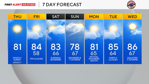
Warm afternoons and cool nights end the month of July in Pittsburgh

Today will be a little less breezy than yesterday, but a northwest wind will continue to bring in comfortable/dry air across our region. The dry air will allow for temperatures to bottom out in the mid-upper 50s this morning, with highs reaching the upper 70s to low 80s this afternoon—fairly seasonable for the end of July.
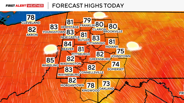
High pressure currently centered near Chicago will center itself across the Upper Ohio Valley for Friday morning, leading to calmer winds and one more very cool morning with low temperatures in the mid to upper 50s areawide.
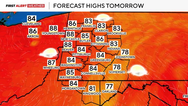
Slightly warmer readings are expected for Friday afternoon along with a few afternoon clouds that will begin to move in as high-altitude moisture moves east in advance of an approaching disturbance that will lead to showers and storms this weekend.
Most of Saturday will be dry with mostly cloudy skies and warm temperatures. Some dry air in the low levels will generally keep rain chances at bay, but as moisture levels increase Saturday evening, widely scattered showers will develop around and shortly after sunset.
Most of the rain will occur Saturday night and Sunday as a weakening surface low and its associated frontal boundaries move toward our region. Right now, the probabilities of heavier rain for Sunday are greatest in the Laurel Highlands, but this may shift a bit depending on the speed of the system and location of a cold front Sunday afternoon and evening.
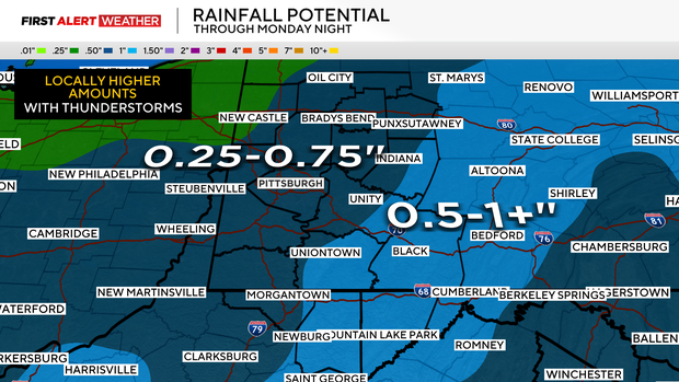
This does not look to be a setup for severe thunderstorms, but a few non-severe thunderstorms are still possible. Most locations will see 0.25"-0.75" of rain with isolated 1"+ amounts.
Showers will linger Sunday night into Monday morning, then areas of fog are likely into Monday morning with light winds and generally cloudy skies.
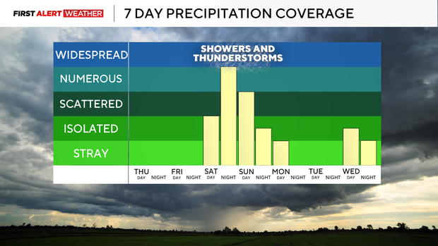
A stray shower or storm is possible over our Northern West Virginia counties Monday afternoon with the front dissipating across those locations. High pressure will lead to clearer skies next Tuesday, but a warmer air mass and pattern is likely to build in toward the middle to end of next week.
There is a high probability of above-normal temperatures into the first full week of August.