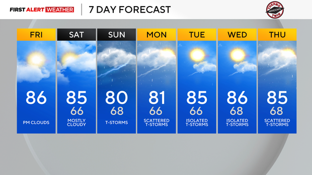
The first half of the weekend in Pittsburgh will be dry before rain and storms move in on Sunday

High pressure is in place across the upper Ohio Valley and the lower Great Lakes this morning, resulting in clear skies, calm winds, and cool temperatures.
Temperatures will quickly rise from the mid-upper 50s this morning to the low to mid 80s this afternoon and evening. Mid and high-level clouds will stream through the day in advance of an approaching disturbance currently moving across the Missouri River Valley/Midwest States.
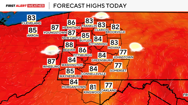
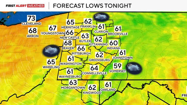
Overnight into Saturday morning will not be as cool thanks to light southeasterly winds and clouds moving in. Waves of clouds mixed with a few breaks of sun are expected on Saturday. With southerly winds in play, temperatures are expected to once again reach the low to mid 80s.
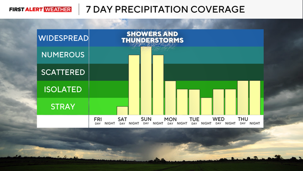
Model guidance has slowed the forward progression of the incoming system in the Midwest for Sunday. This means the highest chance of rain will hold off now until the very late evening hours of Saturday into Sunday morning. There may be a break in the showers on Sunday midday-early afternoon, but this will allow the atmosphere to destabilize some for a second wave of showers and storms in the afternoon and evening hours.
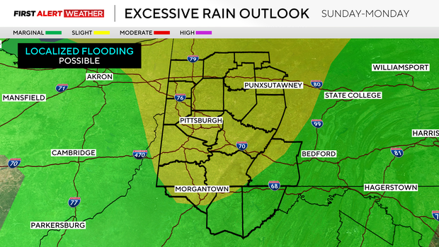
With increased instability and sufficient wind shear, a severe storm cannot be ruled out. Atmospheric moisture values will also be well above normal in the vicinity of the system, so rainfall rates in a few storms will be high enough to result in the potential of localized flash flooding.
As the trough with Sunday's system slows down and eventually becomes "cut off" from the main steering winds, this feature will meander to our west for Monday and Tuesday, resulting in a daily isolated to scattered storm chance through midweek. It will also be much more humid next week thanks to light southerly and southwesterly winds.
Total rainfall amounts through Tuesday night across our region will range from 0.5" to locally near 2". These amounts will vary due to the localized nature of thunderstorms, so not everyone will get slammed with rain. Based on model trends, the areas more likely to see some higher totals will be from the PGH metro and points north toward I-80 and west of I-79 into Ohio.