Cold front moves in on Sunday evening leading to fall-like temperatures to start next week
Scattered showers and isolated thunderstorms occurred overnight, pretty much in the locations that were forecasted. A few fortunate folks were able to receive between roughly 0.25-0.5" of rain, but most did not receive that much.
WEATHER LINKS:
Current Conditions | School Closings & Delays | Submit Your Weather Photos
If you did not get the rain overnight, good luck with moisture in the coming days because outside of a few isolated to widely scattered rain chances Sunday evening, Monday, and Tuesday, there is no indication of a widespread soaking rain for the foreseeable future.
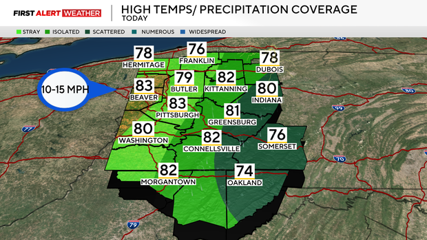
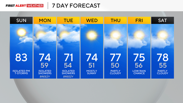
This drier pattern comes with a strong cold front, northwesterly flow, and high pressure that will move in this wee,k leading to several days of below normal temperatures, which is certainly a plus for this time of year. The actual cold front will pass through on Sunday night into Monday morning with increasing winds and falling temperatures.
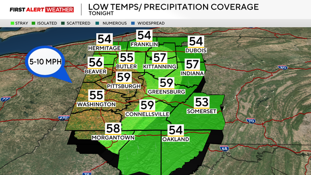
Cool air will finish transporting into the region by Tuesday and Wednesday, which is when we anticipate our coolest daytime highs—generally in the upper 60s to low 70s. Some lake-enhanced showers may affect the central to northern third of our forecast area Monday and Tuesday afternoons, but precipitation would be brief, and quantity would be light.
The coolest mornings for this week will likely be Wednesday and especially Thursday as high pressure settles in, leading to a clearing of skies during the overnight hours.
Temperatures will begin to moderate somewhat by the end of next week as a large trough begins to lift out of the region and milder air flows in from the west, but the large-scale pattern looks to continue to remain fairly dry, which will likely allow abnormally dry and even moderate drought conditions to grow across the area.
Stay up to date with the KDKA Mobile App – which you can download here!