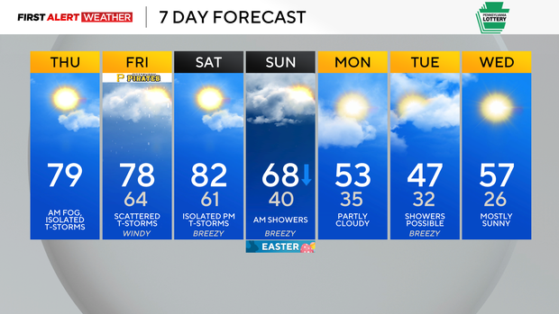
Warm and muggy weather ends the week in Pittsburgh, storm chances linger
Thursday morning begins with overcast skies, cool temperatures, fog, and light rain across most of western Pennsylvania and northern West Virginia. Most of our forecast area is on the cool side of a stationary boundary that is positioned near the I-68 corridor.
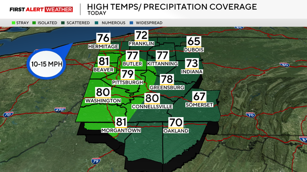
This stationary front will turn into a warm front and lift north all the way to the I-80 corridor by late afternoon and evening hours. Scattered showers will move across our area from now through 11 a.m. Some isolated t-storms may redevelop during the late afternoon and evening hours, especially east and south of Pittsburgh into the Ridges and northwest toward the I-80 corridor.
High temperatures for Thursday will reach the mid 70s to near 80 for most of our forecast area.
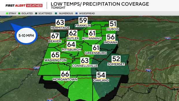
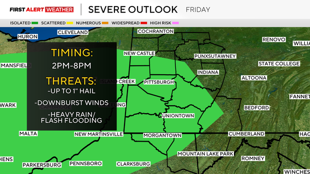
Tonight into Friday, the better chance of scattered to isolated showers and storms will primarily focus itself across our northwest and northern zones as another weak front attempts to push south into western Pennsylvania, but fails to pass through. Between 2-8 p.m. on Friday, as daytime heating and instability build, this may support an isolated severe storm risk with up to quarter-sized hail and downburst winds as the primary threats, along with locally heavy rainfall with storms.
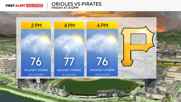
Temperatures will peak well into the mid to upper 70s on Friday afternoon and evening, along with dew points in the low 60s, which will make the air feel muggy.
The warmest day of the next seven will occur on Saturday as southerly flow increases ahead of a strong cold front and upper-level wave of jet stream energy. This will result in highs reaching the upper 70s to low 80s areawide. Some isolated afternoon storms are possible, but the best chance of rain and storms will not occur until after sunset into the predawn hours of Sunday.
There is a level 1/5 severe risk in place, but this could be increased if storm fuel and moisture levels trend higher ahead of this system.
Some lingering showers are expected through Easter Sunday morning. Skies will trend partly to mostly cloudy with substantially cooler conditions by afternoon and evening. The ground will likely be very saturated for those doing Easter Egg hunts due to the previous days of rain.
Next week starts with slightly below normal temperatures, which equate to highs in the 50s and 40s. We also expect a hard freeze by next Wednesday morning, which serves as a reminder that it is still way too early to plant sensitive plants.