Evening storm chances linger in Pittsburgh, but most of the day will be dry

Another day and another storm chance today. Today's storm chance is highest from 4 p.m. through 7 p.m. While we wait for storms to develop and come through, it'll be a hot one.
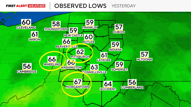
The average high for today is 63 degrees, with the average low coming in at 41. I have our highs today hitting 81 degrees (we hit 84° yesterday) with morning lows dipping to just the mid-60s. Temperatures have been so warm that we saw new records being set in Pittsburgh, Wheeling, and Morgantown yesterday.
More records will likely be broken today due to just how warm our low temperatures are going to be.
Getting back to today's storm chance, most of your day today is going to be dry.
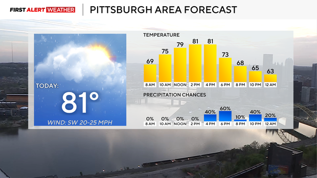
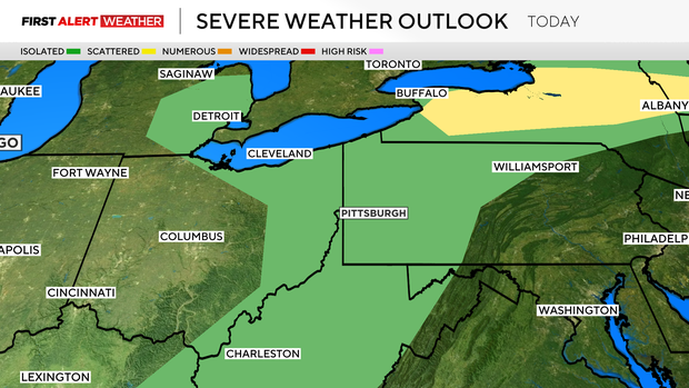
I have the highest storm chance coming from 4 p.m. to 7 p.m., with an isolated storm chance after 7 p.m. through around 10 p.m. Nearly everyone will be dry through 4 p.m. Strong wind is the biggest concern for this afternoon as a loose line of showers and storms will work its way through our area, traveling from the west to the east.
Frequent lightning and downpours should also be expected with any storms that develop.
While we wait on the storms, highs today should shoot back up to the 80s. I have Pittsburgh seeing a high of 81 degrees, with noon temperatures just a tick or two shy of the afternoon highs. Morning temperatures dipped to the mid-60s.
Winds will again be gusty, coming in from the northwest at around 10 mph. Winds will gust to the mid-20s this afternoon.
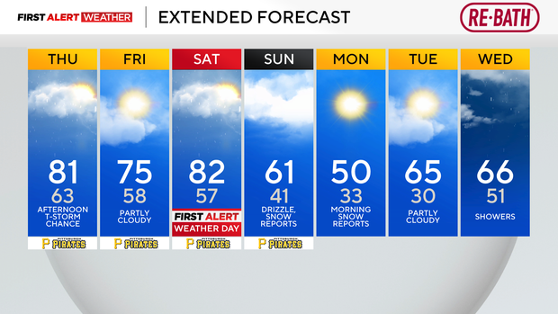
Looking ahead, we will get a break from the heat and the storms on Friday with highs just hitting the upper 70s. Saturday's storm chance will likely be the highest of the week.
Straight-line wind, large hail, and tornadoes can't be ruled out. Behind Saturday's storms will come cooler weather.
I expect we will get a couple of light snow reports on both Sunday and Monday morning.