Temperatures cool in Pittsburgh on Thursday, wind advisory in place for Friday
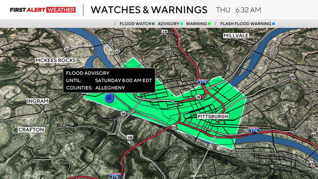
Wednesday was a record-setting day with 1.29" of rain falling at the NWS offices in Moon. The old record was just 0.89" of rain set in 1935. The record rain has us watching for minor flooding in some spots, including the Ohio River at the Point. The Ohio River at the Point is under a Flood Advisory through Saturday morning.

River levels are expected to hit 18.5'. At that height, the Mon Wharf floods.
The river is expected to crest on Friday evening.
Getting to today's forecast, we have already seen the daily high of 37 degrees. That is right there with the average for this time of the year. Yesterday's high hit 69 degrees.
I have us seeing temperatures near 40 degrees this afternoon. Noon temperatures should be in the mid to upper 30s. Skies will be cloudy in the morning with sunshine breaking out from clouds after 2 p.m.
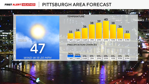
Winds will be out of the northeast at around 15 mph.
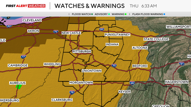
We have another fast-moving mid-level low that will sweep through on Friday. While our rain and snow chances will be low from this system, wind speeds will pick up through the day, with some communities seeing winds up to 50 mph. The strongest winds will occur during the afternoon hours.
Friday highs should hit the 50s, and I will keep an isolated to scattered snow and rain chance in for the day. Pittsburgh may be dry all day long, but places north of Pittsburgh should see a wintry mix off and on in the morning and afternoon.
Saturday will be dry and cool with highs in the mid to upper 40s. Morning lows are going to be in the low 30s and even some 20s. St Patrick's Day events will be going on in the morning hours, and it will be cold, but it does at least look dry.
Sunday sees a brief warm-up with highs near 70. Monday morning rain and snow chances will be the start of colder temperatures moving in behind the cold front.
