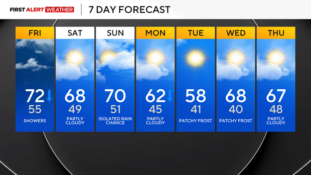
Rain moves into the Pittsburgh area this weekend and more fall-like weather begins

Temperatures will be snapping back to near average for the weekend after we hit 83° yesterday for the daily high in Pittsburgh. Yesterday was the warmest October start in Pittsburgh since 2019, when we hit 88° for the daily high. The record high for the 1st of October still stands at 89° (1881), and there was no real chance we were going to get close to that yesterday.
Temperatures will dip behind a cool front that arrives later this morning, with the rest of the weekend being seasonal. Light rain will accompany the arrival of cooler air.
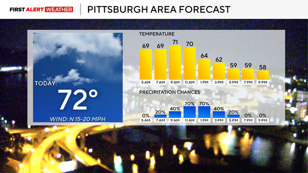
As of 3 a.m., rain seems to be slightly behind schedule when it comes to the timing that I have talked about over the past couple of days. It still appears that kids walking to school in the morning will be dry. If you have plans for them to walk home, there will still be some rain around as late as 4 p.m. in Pittsburgh and even later for communities south of Pittsburgh.
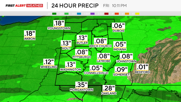
I still think high school football action will be dry, but some showers could linger into the evening for communities south of Pittsburgh. The chance for rain to impact high school football will remain low. Rain totals should be around a quarter of an inch. That is down from what data was showing earlier this week.
I have high temperatures today hitting the low 70s, with highs in Pittsburgh to the north being hit before noon. Temperatures will be falling all afternoon and evening, with breezy winds coming in from the northwest during the afternoon. Morning winds will be out of the southwest. I have Pittsburgh seeing a temperature near 70 at 8 a.m. I have noon temperatures in the mid-60s. I have the 4 p.m. temperature near 60°. Temperatures will be in the upper 50s for high school football.
Saturday and Sunday will be seasonal, with highs near 70 both days. Morning lows on both days will also be near 50 degrees. We should see plenty of cloud cover on Saturday, but there should be some times with some sun early on Sunday before more clouds roll in.
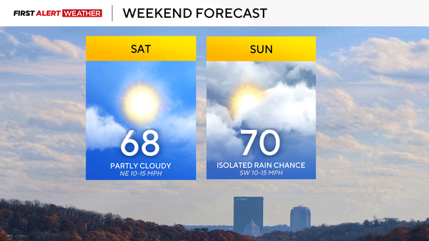
After today's rain threat, our best chance for rain over the next week will come Sunday. The chance is low, and while low, it's 'highest' to the southeast of Pittsburgh. For the past three days, model data has continued to show a mid-level low that stays well to our southeast. Data today is lifting the low-pressure system further north, possibly bringing some very light rain our way. A cool front that moves through on Monday morning may also bring some light and brief showers our way.
Monday's cool front will push temperatures down, with highs on Monday just hitting the low 60s. I have highs in just the 50s on Tuesday, with seasonal weather returning on Wednesday. Next Tuesday and Wednesday, we may see temperatures cool enough for frost development along and north of I-80, along with higher elevations of the Laurel Highlands and ridges of Fayette and Westmoreland counties. It would be the first frost of the season for communities north of I-80 if it occurs.