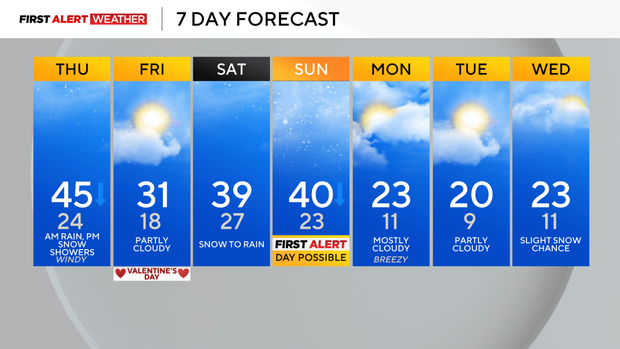
Rain in the morning with gusty winds and snow showers during the evening
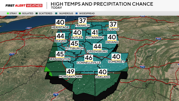
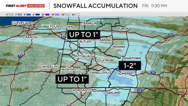
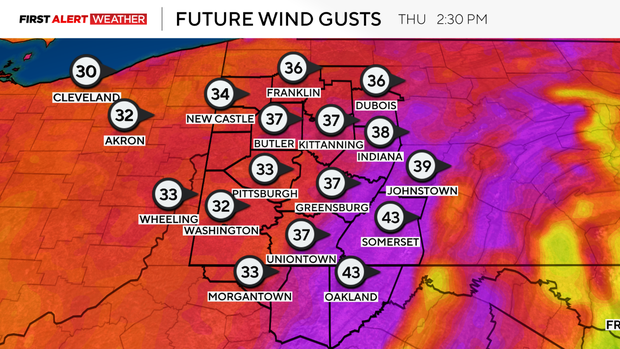
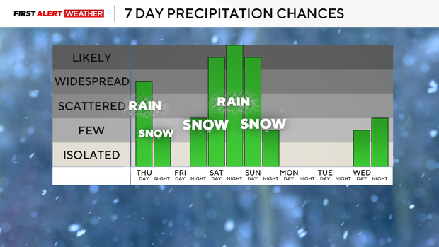
PITTSBURGH (KDKA) - There's widespread rain moving across Western Pennsylvania early Thursday morning, and will continue to do so through 10 a.m. - 11 a.m. this morning. Virtually almost everywhere is above freezing with the exception of a few counties in the Laurel Highlands. This is where some icing may be possible Thursday morning, but all other locations should see rain. A cold front will move through mid-morning leading to falling temperatures and strong wind gusts throughout the day. Winds will gust out of the west up to 30mph - 40mph. As a strong mid-level disturbance swings in from the west later this afternoon behind the cold front, this will induce some scattered snow showers. There could be brief, localized heavy bursts of snow that result in a quick dusting to 1 inch of accumulation in spots, so afternoon and evening drivers should be on the lookout between 4 p.m. - 9 p.m.
WEATHER LINKS:
Current Conditions | School Closings & Delays | Submit Your Weather Photos
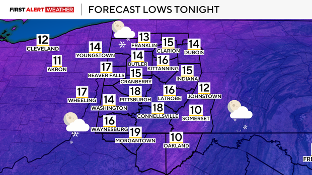
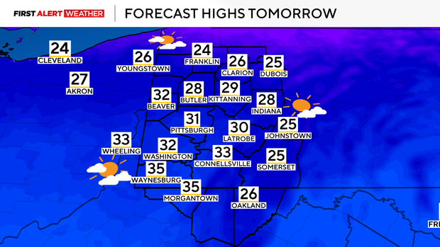
Temperatures will fall into the low 20s late in the evening as cold air continues to settle into the region. On Friday, high pressure settles into the Ohio Valley and Lower Great Lakes with partially clear skies and seasonably cold temperatures. Temperatures in the morning will be in the teens, with daytime highs maxing out in the upper 20s to low 30s. This high will quickly move to the east on Friday night as another powerful low pressure gears up to the southwest and moves toward the Ohio Valley and Lower Great Lakes by Saturday and Sunday. Precipitation types will vary this weekend, likely starting with snow Saturday morning, shifting to rain Saturday afternoon and night, then switching back to snow as the cold air moves in on Sunday afternoon. The latest trends with the model guidance show a slightly more progressive wave of low pressure that may not come as far north as previously modeled. This would result in slightly colder air and quicker transition to snow on Sunday along with very gusty winds. We are still a few days out from the arrival of this system, so minor adjustments are possible, but impacts to travel will be possible Sunday afternoon and evening.
Behind Sunday night's system, well below average temperatures will settle in for the beginning of next week with highs in the low 20s and lows in the upper-single digits to low teens. Another system may move toward our region by next Wednesday and Thursday with a chance for some snow.
Stay up to date with the KDKA Mobile App – which you can download here!