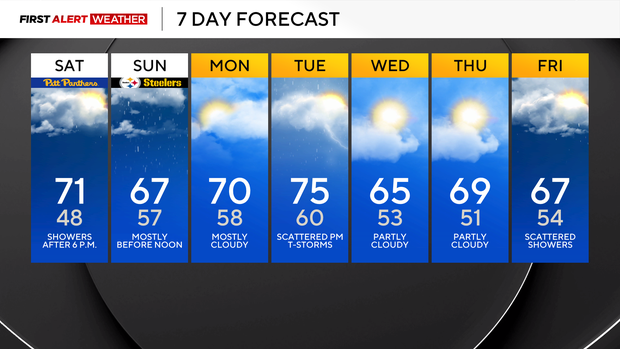
Rain from Hurricane Isaias to hit the Pittsburgh area on Saturday night

For most, it's just going to be a rainy evening and morning. Isaias, what was once a Category 3 hurricane, is now 'post-tropical.'
This means that the internal structure of the storm has transitioned from that of having a warm core to a more normal system driven by changes in airmass around the system and showing a warm sector on its southern side. As of 4 a.m., the center of Isaias is located west of Birmingham, Alabama, along the Mississippi-Alabama border. As the storm moves north, communities from Georgia into the Carolinas will have a tornado risk and will see plenty of rain.
For us, the timing of our rain due to the system has again moved forward, with rain starting maybe as early as 6 p.m. this evening. I will maintain a scattered rain chance from 6 p.m. through 1 a.m., with widespread rain starting up at 1 a.m.
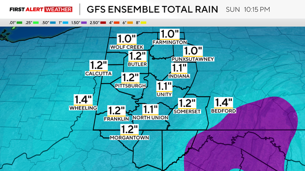
The heaviest rain from the system will move through our area from 1 a.m. through 11 a.m. on Sunday. There will be scattered showers still around on Sunday afternoon, with the highest chance of those lingering showers being for places south of I-70.
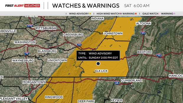
Wind speeds will also pick up, with wind gusts being strong enough for a wind advisory to now be issued for Somerset County and the Ridges of Fayette & Westmoreland Counties. Rain totals of around an inch should be expected.
Getting back to the forecast, highs today should hit the low 70s with mostly cloudy skies. Most of the day will be dry, with rain moving in just before sunset.
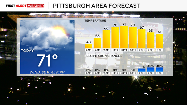
Noon temperatures will be in the upper 60s already. Winds will be breezy, coming in from the east at 10-20 mph.
Sunday highs will hit the upper 60s. We'd easily be in the 70s if it wasn't for rain chances. Morning lows on Sunday will only dip to the mid to upper 50s.
Most of the Steelers game is looking dry, but there will be rain chances in place for the event.
Next week will see temperatures remaining above average for most of the week, but just barely. Rain chances will be highest on Tuesday and Friday, but there is no consistency or agreement when it comes to model data right now on the timing of rain after Sunday.