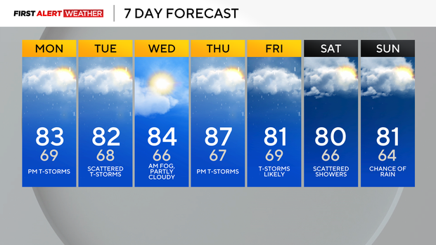
Pittsburgh's hot weather turns into cool, humid and rainy conditions this week

Parts of our area received very heavy rainfall with strong to severe thunderstorms for the third day in a row.
First Alert: Through Sunday evening, due to localized flash flooding
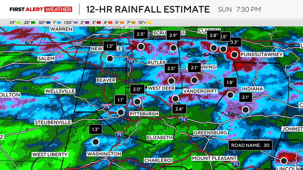
At Pittsburgh International Airport, 1.97 inches of rain fell through 7 p.m., breaking the old daily rainfall record of 1.89 inches set in 2005.
Doppler radar estimates show between 1 and 4-plus inches of rain occurring along a line roughly from the Pennsylvania-Ohio border east through New Castle, Slippery Rock, Parker, and Punxsutawney.
We've had severe flash flooding reported in Slippery Rock, Parker, and several areas of southern Clarion County where multiple roads have been reported underwater. Another swath of very heavy rain occurred along a line extending from the Pittsburgh airport northeast to Ross Township, New Kensington, Kittanning, and Indiana.
Through the overnight hours, some isolated to widely scattered showers and storms currently in eastern Ohio will make a run for our area. The atmosphere has been overworked heavily by this afternoon's storms, but there's still enough moisture and instability for at least a few of these to persist through the overnight and morning hours of Monday.
A slow-moving upper-level shortwave currently in the state of Indiana will slowly meander east toward our region, keeping elevated rain and thunderstorm chances around through Tuesday.
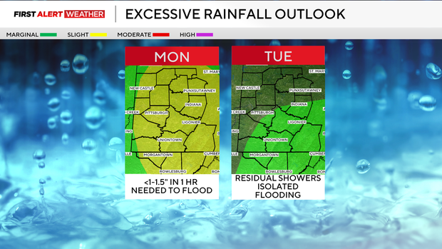
Some slightly drier air may move into areas southwest of Pittsburgh, leading to a lower-although non-zero chance of rain there on Monday, but as of now, modeling is most bullish on triggering convection for areas northeast of the Turnpike and into the Laurel Highlands and Ridges. These will be slow-moving showers and storms, so heavy rain and flash flooding are a concern for Monday.
On Tuesday, this disturbance will have moved farther east, but will still linger close enough to bring a scattering of rain and thunderstorms.
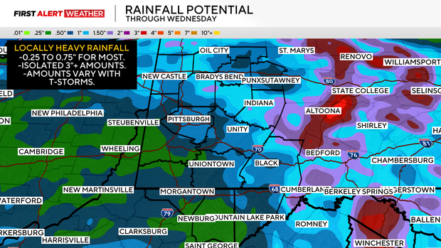
The flash flood risk on Tuesday will be lower, but still present, especially from the Pittsburgh metro and east into the Laurel Highlands and Ridges. Total rainfall amounts over the next 48-72 hours will range from 0.25 inches to 0.75 inches for most. There is still the possibility of isolated areas receiving as much as 3-plus inches of rain, so be on alert if a thunderstorm heads for your area and is slowly moving.
Wednesday looks to be our day with the lowest chance of rain at the moment, with upper-level ridging in place. Another trough will move into the region by Thursday afternoon, leading to increased moisture values and showers and storms. Some heavy rainfall and possibly severe storms cannot be ruled out Thursday night into Friday. Regarding next weekend, models are in two different camps for how the large-scale pattern shapes up.
Some modeling suggests a surge of drier air moves in behind Friday night's cold front, ending rain chances by Saturday and Sunday.
Other modeling suggests there will be a third wave of low pressure keeping precipitation chances elevated, so as of now, I've opted to leave a chance of showers in, and we'll adjust as we get closer to this weekend.