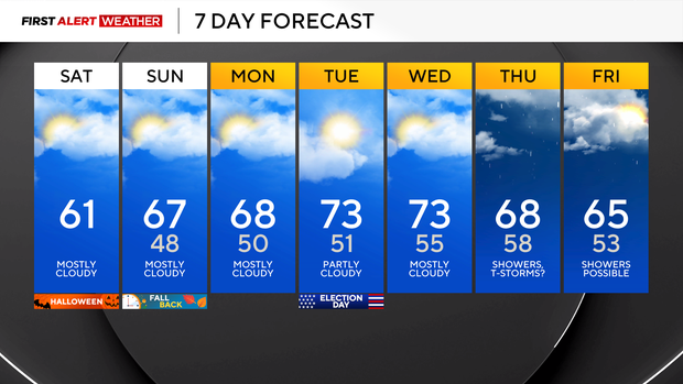
Pittsburgh will have dry weather and unseasonable fall warmth through the weekend

Our ongoing dry stretch is currently at Day 14 and, by the end of today, will reach 15 days for the Pittsburgh metro area. High pressure is in place this morning, leading to calm winds and cool temperatures, with most areas in the mid-30s outside the urban heat island of Pittsburgh and in the lower 40s.
This weekend will be dominated by plenty of mid- and upper-level cloud cover thanks to upper-level winds blowing off the tops of precipitating clouds across the Midwest and Plains States.
Despite the mid- to high-level clouds, very dry air in the lower levels of the atmosphere will prevent precipitation from occurring.
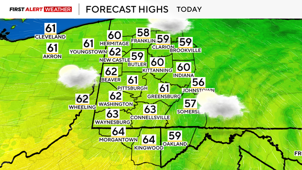
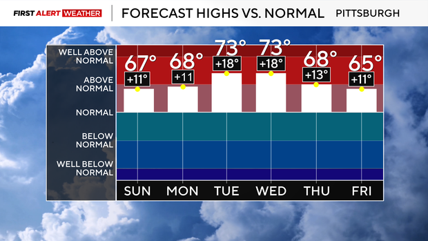
Highs today will reach the lower 60s, then as winds shift to a more southerly direction on Sunday, that will start the process of warm air advection, with daytime highs reaching the mid-upper 60s. Daytime highs will continue to soar well into the 60s and low 70s this upcoming week, with the warmest days Tuesday and Wednesday, which are 15-20 degrees above normal.
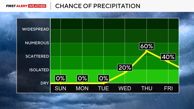
Stubborn high pressure that has largely been in place since October 17 may finally begin to break down by this upcoming Thursday into Friday, allowing the first shot of measurable rain many of us have seen in a couple of weeks.
A system currently off the US West Coast will move east thanks to a strengthening push of jet stream winds in the Pacific Ocean. As of now, most modeling is in agreement that this system will move across our area Thursday, with potentially a secondary wave coming in on Friday. Rainfall amounts do not look heavy by any means, but at least we will end the ongoing dry stretch.
There remains no indication of any major blast of cold air for the foreseeable future, thanks to a strengthening Pacific jet stream that will push mild air across the US through the next couple of weeks.