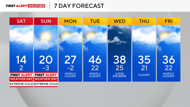
Extreme cold expected this weekend across Pittsburgh, rest of western Pennsylvania
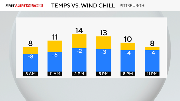
We started off in the teens at midnight, and now temperatures will fall throughout the day. Some will get back to the low teens this afternoon, but we will end near or below 0 by midnight and dip below zero by Sunday morning.
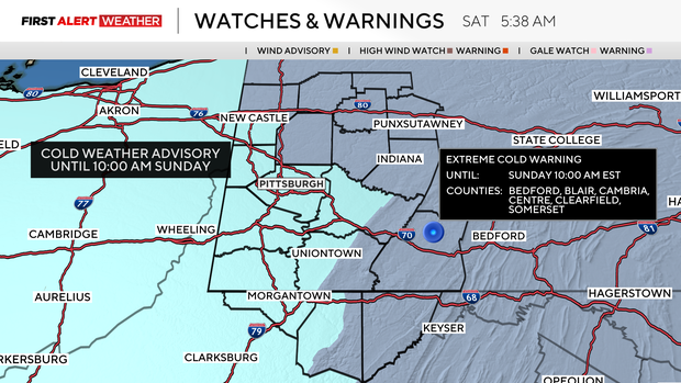
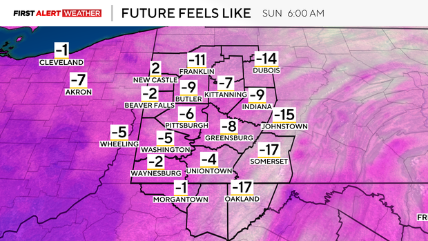
The Extreme Cold Warning and Cold Weather Advisories go until 10 a.m. Sunday. Wind gusts will peak up to 30-40 mph, and wind chill values will range from -10 to -20. Stay safe out there and limit time outdoors.
Today is the 16th day with temperatures at or below the freezing mark, and it looks like we won't get above 32° until Tuesday. Remember, if it's too cold for you, it's too cold for your pets!
Roads are still slick from last night's snow squalls. We picked up around 1-3", so the roads could still be snow-covered today. There is almost 40" of snow for the season so far!
This week, we finally warm up and stay dry with some sunshine. We are still keeping a very close eye on flooding potential with the big thaw ahead.
Highs will be in the 40s on Tuesday and Wednesday with lows in the 20s for the week, so it does look like it'll be a gradual melt. Our highs will then be near the freezing mark for the end of the week, with a small chance of rain and snow showers.
Stay up to date with the KDKA Mobile App – which you can download here!