Pittsburgh Weather: Temperatures continue their climb on Thursday
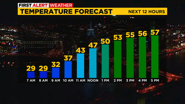
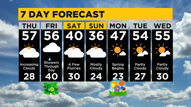
PITTSBURGH (KDKA) - Today will be the best day of this week with highs soaring to the upper 50s and no rain in the forecast.
It is a cold start with temperatures dropping to the upper 20s this morning. Wind speeds are at or below 3mph so that means there is no additional chill in the air. Wind chills are ten to fifteen degrees warmer than yesterday morning. You may have a glaze of ice on windshields that you may have to knock off before starting your morning commute though.
Looking ahead, we only have one system that will bring us rain and snow chances expected over the next week.
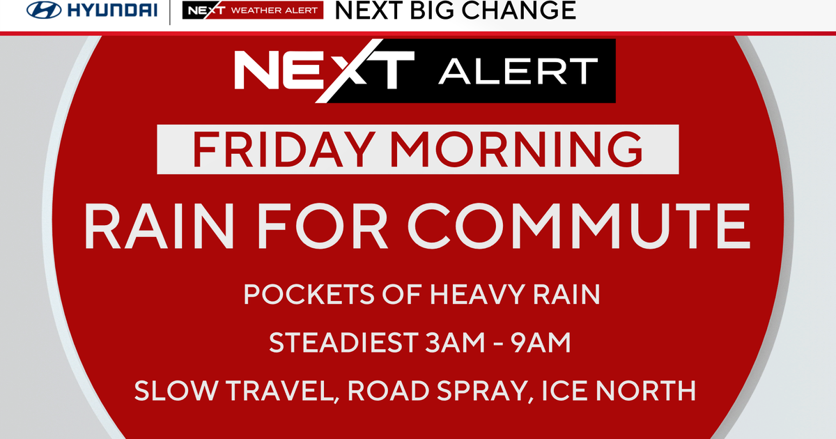
The rain arrives tomorrow morning and will be around for the morning commute. It appears at this point that the rain will be light with just around a fifth of an inch of rain expected through the day. The best rain chance comes in the morning but there will remain a chance for rain in the afternoon and evening as a cool front slides through.
Friday low temperatures will be hit just before midnight on Saturday.
Flurries will be possible Saturday morning.
Even with the rain around, Friday highs will still reach the mid-50s. Saturday highs will be just around 40 degrees and will probably be hit at midnight.
Saturday morning will be windy. Sunday will be the coldest day of the next week with temperatures dipping to the mid-30s for afternoon highs.
The next workweek is looking pleasant with Monday highs in the 40s.
The spring equinox occurs at 5:24 p.m. Tuesday highs will be in the mid-50s with highs also in the mid-50s on Wednesday. Mornings will remain cool next week with most mornings seeing temps dipping to the 20s.
This also means we should see plenty of sunshine next week.
Stay up to date with the KDKA Mobile App – which you can download here!