Pittsburgh Weather: Chances Of Severe Weather Kick Off The Week
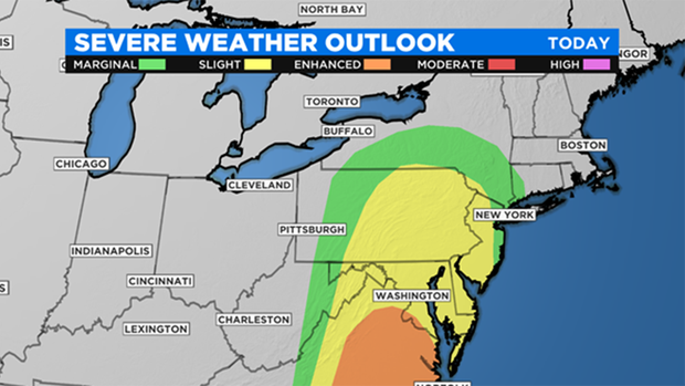
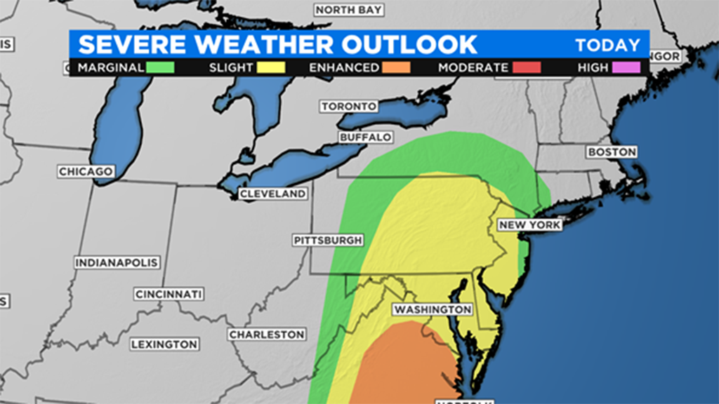
PITTSBURGH (KDKA) -- There is a low chance for severe weather this morning with straight line wind being the main concern.
The NWS issued a Severe Thunderstorm Warning for parts of Fayette County, including Masontown, Oliver and Uniontown. It is in effect until 11:45 a.m.
Temperatures nearly hit 70 degrees yesterday with Pittsburgh hitting 69 degrees for a high.
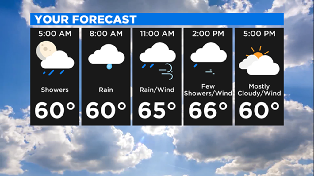
Today will be a busy weather day with high temperatures near 70 degrees again even with rain showers and storms around early.

If we see any severe weather, it would come this morning ahead of a cold front.
The cold front passes through around 12:00 noon.
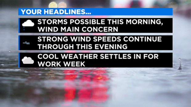
Rain chances will drop behind the front, but some light rain will still be possible this afternoon.
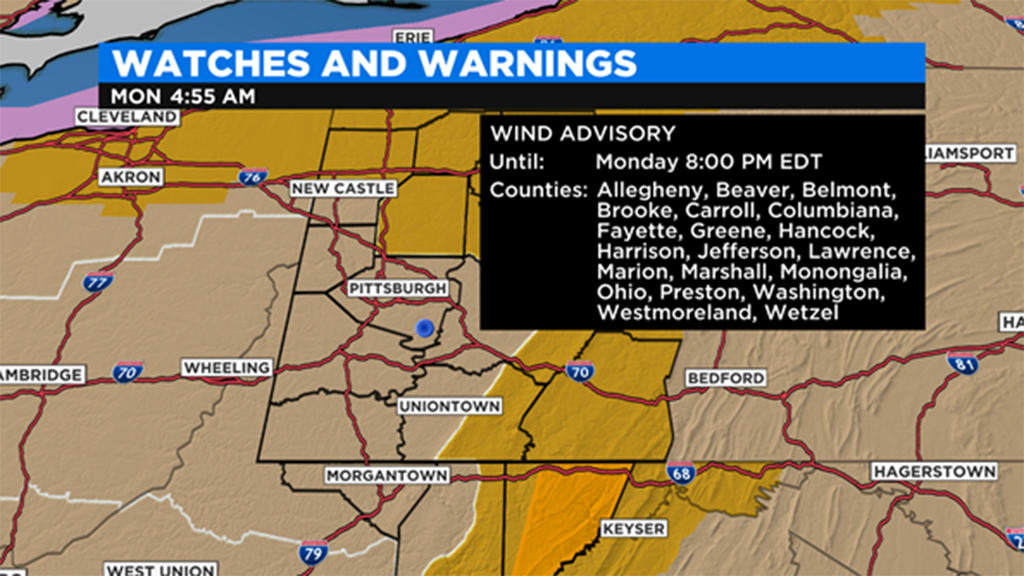
Wind speeds will really pick up this afternoon, with wind gusts potentially topping 50 mph in Pittsburgh and gusts of higher than 60 mph possible along the snow belt in Armstrong and Indiana county along with the Laurel Highlands.

The week ahead is looking cool with high temperatures in the mid-40's expected for Tuesday.
Tuesday may be the only completely dry of the week with rain chances back on Wednesday.
Rain showers could change to another round of snow showers on Thursday morning before we dry out for the afternoon.
Rain and storms will be possible on Friday with just light rain chances around for the upcoming weekend.
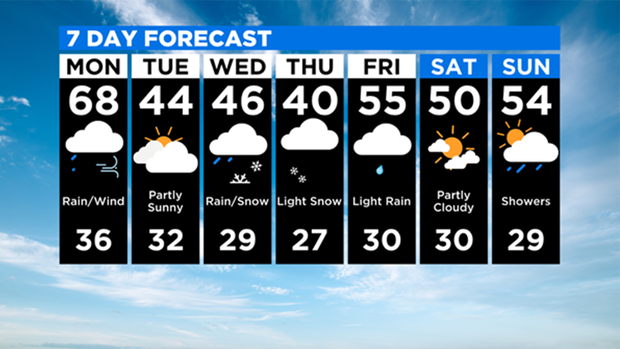
Besides today, the next warmest day of the week looks to be on Friday with forecast high temperatures in the mid 50's.
WEATHER LINKS:
Current Conditions | School Delays & Closings | Local Radar | Weather App | Photos
Stay up to date with the KDKA app, which you can download here.


