Pittsburgh Weather: Possible Slick Conditions Monday Morning
PITTSBURGH (KDKA) -- We have an active work week ahead with the chance for rain practically every day.
This morning there's a Winter Weather Advisory starting at 7:00 AM until 1:00 PM for areas north of I-80 and along the ridges.
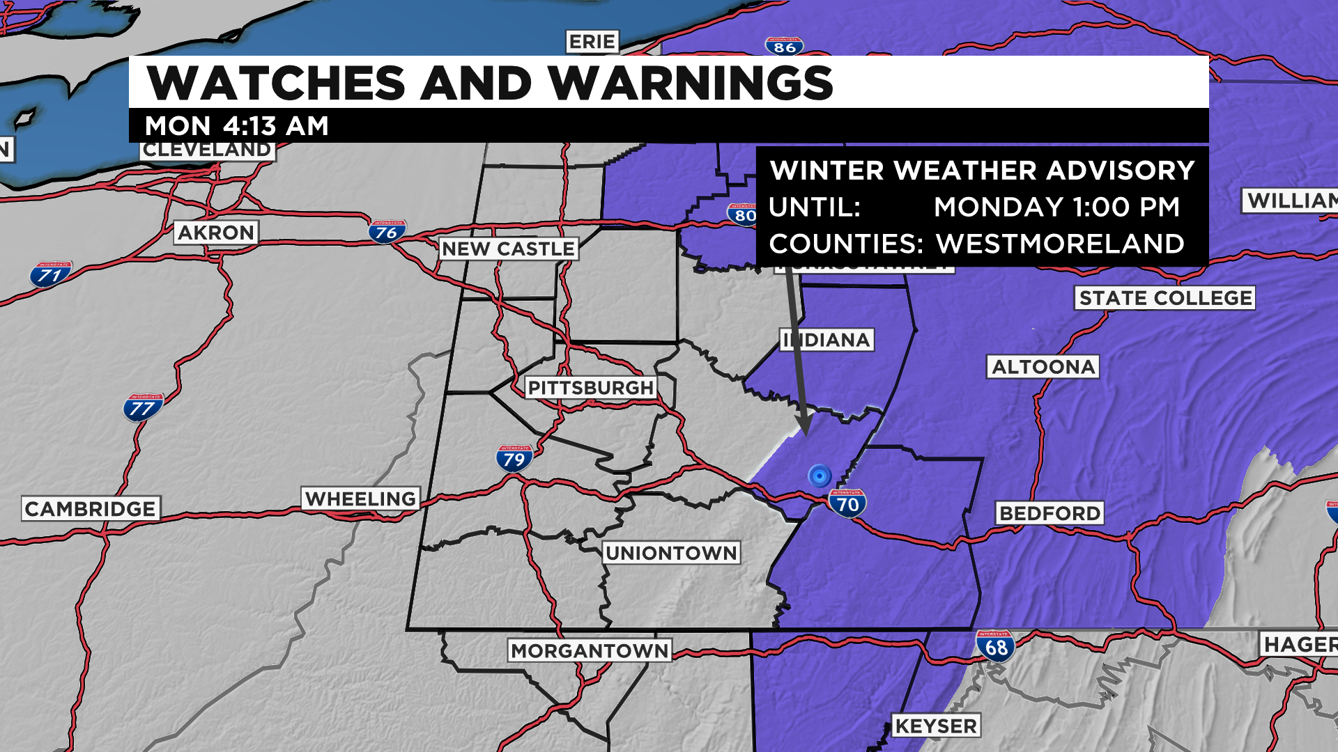
There won't be much snow accumulation, but the big concern is a light glaze of ice and 1" of snow which could cause slick conditions.
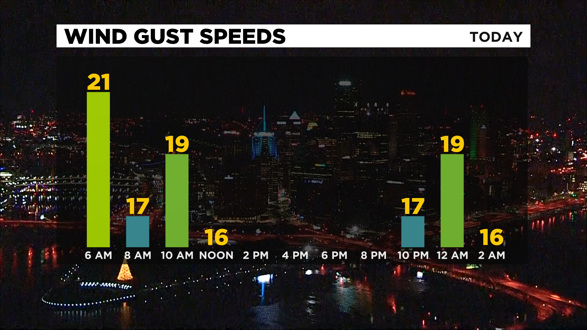
This afternoon highs will be well above normal (no surprise here) in the low 50s with occasional wind gusts as high as 20 mph.
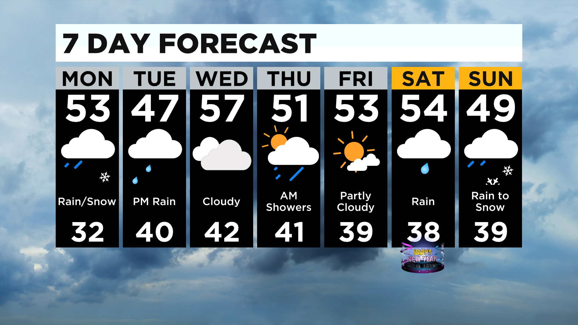
Overnight more rain is possible with lows near 40. Tomorrow afternoon another mix is possible but mostly just wet snow and no accumulation with highs staying 10 degrees above average in the upper 40s.
Wednesday will be the warmest day of the week with a few showers and highs in the upper 50s but the days to follow won't be too far off with each day in the upper 40s and low 50s.
The next day with the driest time looks to be Friday with some sunshine before more rain and snow arrive heading into the New Year.
So far this month we've seen 2.58" of precipitation and average is 2.28" so we are not far off, but temperatures are 5.7 degrees above normal and we are still sitting about 6" below normal for snowfall this month with only .2".
After this week we will most likely be over 6 degrees above normal and above normal for precipitation.
WEATHER LINKS:
Current Conditions | School Delays & Closings | Local Radar | Weather App | Photos
Stay up to date with the KDKA app, which you can download here.