Pittsburgh Weather: More snow expected to move through on Sunday
PITTSBURGH (KDKA) - That winter storm has passed, but we're still not done with the snow quite yet!
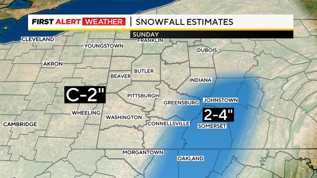
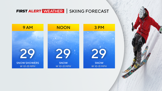
We're going to see scattered snow showers last throughout the day. We could pick up another additional 1-2" of snow around the lower elevations, and higher elevations could see another 2-4" where they have a Winter Weather Advisory in place through 1 a.m. tonight.
WEATHER LINKS:
Current Conditions | School Closings & Delays | Submit Your Weather Photos
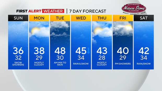
Great for those ski resorts! Highs this weekend will be chilly in the mid-30s. Be careful if there are any snow squalls as travel conditions can quickly deteriorate if snowfall rates create whiteout and slippery conditions.
Monday will be our driest day with mostly cloudy skies. Another storm system will be moving in on Tuesday, but this one will be more of a rainmaker by the looks of it.
It will start off with some mixing showers then switch to all rain later on. We're going to monitor this closely since this could bring us more than enough water.
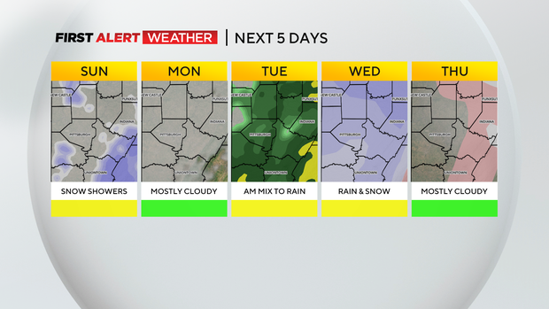
Minor flooding could occur since we are pretty saturated from yesterday's snow. It switches back over to a rain/snow mix on Wednesday, then quiet weather returns on Thursday and most of Friday.
Don't hold your breath because most models are indicating another storm system could move in next Saturday.
Stay up to date with the KDKA Mobile App – which you can download here!