Pittsburgh Weather: Chilly Start To The Weekend
PITTSBURGH (KDKA) -- We are waking up to lows around 20 and a few flurries around.
There's a coating for areas north of Pittsburgh and in the higher elevations.
Little to no accumulation is expected through the morning but watch for slick spots.
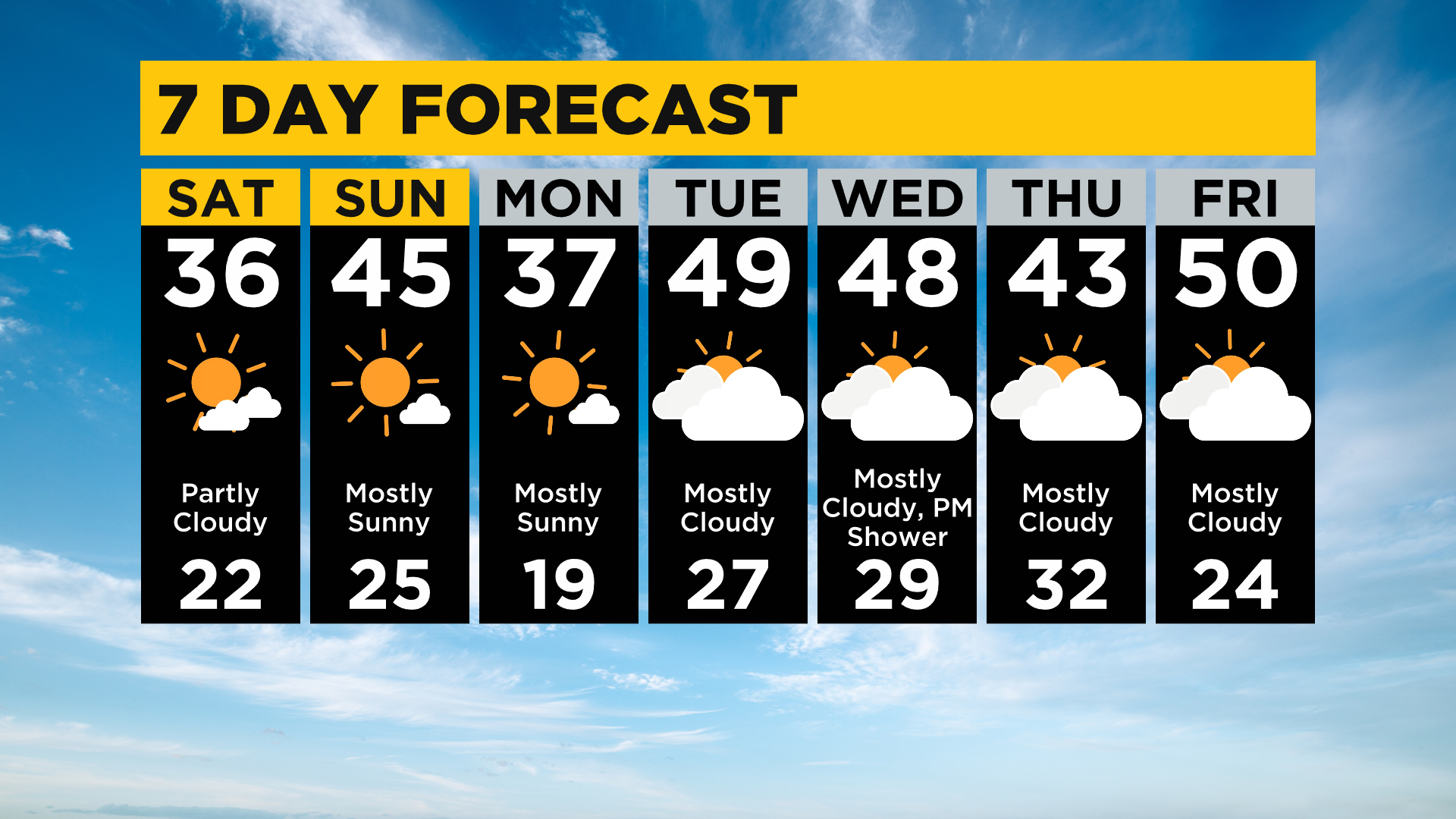
This afternoon will be quiet with mostly sunny skies and highs in the mid 30s. By Sunday warmer air pulls in and highs get back to the mid 40s.

ALERT: None
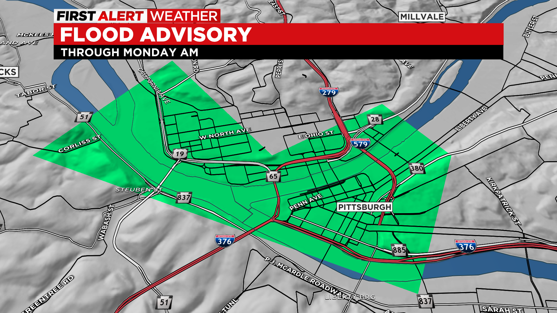
AWARE: Flood advisory for the Ohio River at the Point (Downtown Pittsburgh) goes to Monday morning. The river is expected to crest at 21' this morning. The Mon Wharf will be topped and could get close to the Northshore river walk.
Overnight Sunday a weak cold front moves in with not much moisture associated with it and we could get a few light snow showers with little to no accumulation.
That front brings chilly temperatures back in play for Monday with lows back in the teens and highs in the mid to upper 30s.
WEATHER LINKS
Current Conditions | School Delays & Closings | Local Radar | Weather App | Photos
Tuesday and Wednesday we are back in the mid to upper 40s and even 60s possible for the end of the week and weekend!