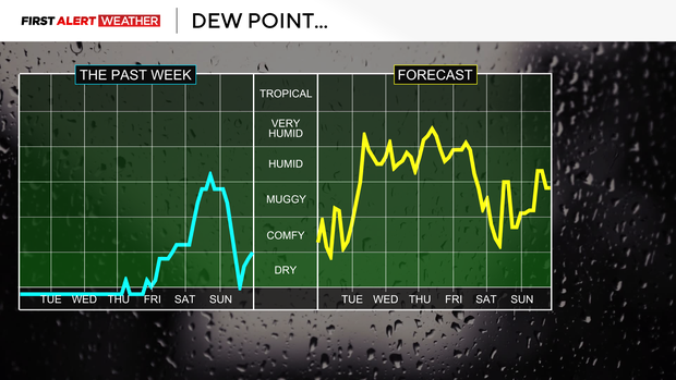
The week begins in Pittsburgh with hot and humid weather with storms looming

Today will be dry. It'll likely be the hottest day of the week with highs close to 90 degrees too. Surprisingly, 850 mb temperatures aren't the highest for a day where some communities may hit the 90s.
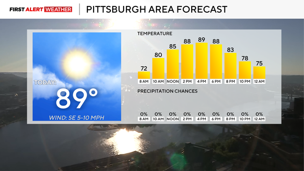
Model data peaks our 850 mb temps at around 16°C. This would normally point to highs in the mid-80s. Bountiful sunshine, light winds, and low humidity levels suggest temperatures running warmer than average. 89° may be a tad too aggressive, but we will be close.
It's not just an hour or two that will be hot. Temperatures will be in the mid-80s at noon. That's after most started off near 60.
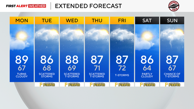
Your entire afternoon to evening will be warm today. For the rest of the week, the heat will be fairly suffocating, with highs hitting the mid to upper 80s most days and morning lows ticking up closer to 70 to start each morning. Storm chances will also be around with a chance for rain and storms all day long on Tuesday.
Right now, it appears our storm chances will be highest on Thursday. Wednesday's storm chance will be nearly as high as Thursday's chance. Gusty wind and large hail would be the main concern.
The area's first two tornadoes of the year happened over the course of the weekend. While we are still awaiting detailed information from ground surveys of the damage, there continues to be enough information to confirm that at least two tornadoes occurred over the weekend on Saturday.

The first tornado is confirmed to have occurred around a mile south of Bentleyville. The second confirmed tornado happened a couple of miles north of Perryopolis.