Pittsburgh temperatures to warm up before a strong, late-week storm system moves through
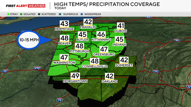
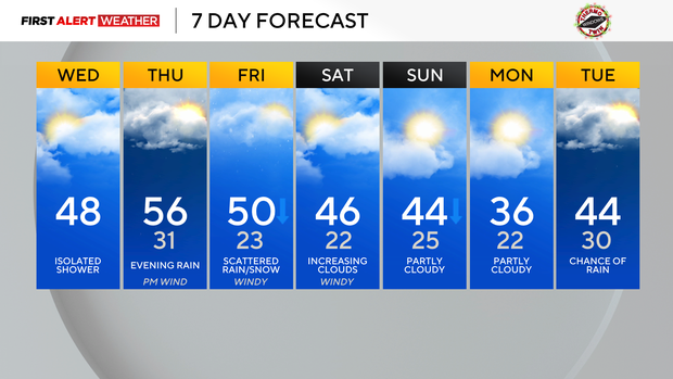
Temperatures are anywhere from 25 to 40 degrees warmer across most of western Pennsylvania and northern West Virginia this morning. Most spots are well into the upper 30s and 40s this morning, which is even warmer than what we were anticipating yesterday. As a result, I've raised the high temperatures for this afternoon a few degrees, with most areas expected to reach the mid to upper 40s today.
WEATHER LINKS:
Current Conditions | School Closings & Delays | Submit Your Weather Photos
This will lead to rapid snowmelt across most of our area. There is a slight chance for an isolated shower or two from mid-morning through early afternoon as a weak disturbance passes through our region. Otherwise, skies will be mostly cloudy with a west-southwest wind around 15 to 20 mph.
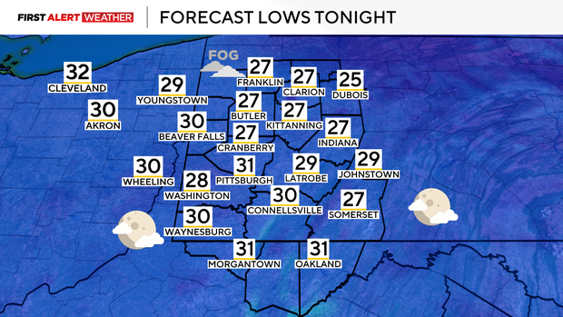
Overnight, skies will clear somewhat, allowing temperatures to drop tomorrow morning.
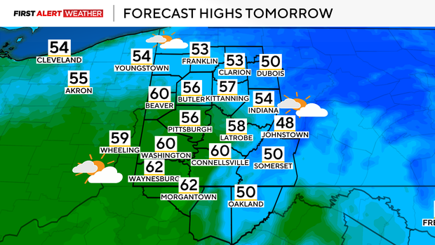
However, a southerly wind will gradually increase through the day, allowing for a rapid warm-up. Most of the day will be dry with high temperatures expected to reach well into the 50s for most, with a few low 60s possible in our southernmost counties. The gustiest winds won't develop until early to mid-evening hours as a strong low-pressure system approaches from the west.
This low pressure will be accompanied by a strong cold front and upper-level storm system that will bring widespread rain. There will be an embedded line of heavier showers that will produce some enhanced wind gusts between 11 p.m. and 3 a.m., but the amount of fuel for actual thunderstorms will remain low. Total rainfall amounts are expected to be between 0.25" and 0.5", which is badly needed considering the rainfall deficit that remains in our area.
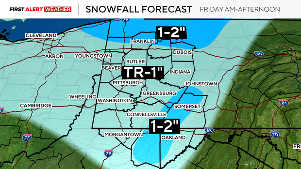
Falling temperatures are expected through the day on Friday, with a high of 50 °F occurring around or just after midnight. Most of the day will be spent in the low 30s with high wind gusts of 40-50 mph. Snow showers are expected as well, with most of the area to see a dusting at best. 1-2" are possible north of I-80 and in some of the westward-facing slopes/peaks of the Laurel Highlands and Ridges.
The cold surge won't last long behind this storm system as temperatures are expected to recover on Saturday with highs in the mid-40s later in the day. Another moisture-starved cold front will move in Saturday night into Sunday, bringing increased clouds and a low chance of showers, followed by another surge of cooler air to start early next week.
Despite the cool start to next week, it is very likely that temperatures will be near to slightly above normal levels, which doesn't bode well for those hoping for a White Christmas.
Stay up to date with the KDKA Mobile App – which you can download here!