More accumulating snow coming to the Pittsburgh area this weekend, could impact travel
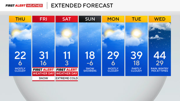
We now have First Alert Weather Days in place for both Friday and Saturday due to impactful weather heading our way.
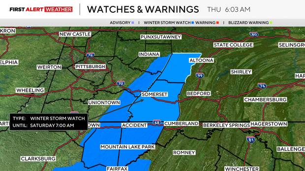
Let's start with Friday, with snow showers expected to arrive as early as 9 in the morning and stick around through the evening hours. Right now, the key reason for the FAWD is going to be evening conditions with snow squalls possible.
WEATHER LINKS:
Current Conditions | School Closings & Delays | Submit Your Weather Photos
These snow squalls will be laying down up to an inch of snow in a very short amount of time.
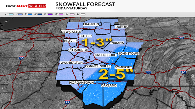
Visibility levels will be low as the main band passes. Roads will quickly become slick with traffic slowed. Winds will also pick up as the bands pass by, potentially blowing snow already on the ground around. Travel will be challenging during the passage of these snow squalls.
Once the snow squall moves out, another blast of cold arctic air will begin rolling in.
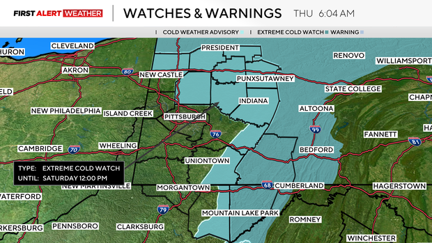
As the air moves in, winds will be gusty, pushing wind chills down into the dangerous range. Extreme Cold Watches have been issued for Saturday morning. Wind chills as low as -25° will be possible on Saturday morning. With wind chills that low, frostbite can settle in in as little as 15 minutes.
I have Saturday morning's low in Pittsburgh dipping down to 3°.
The coldest surface air temperatures of the weekend will occur on Sunday morning, but winds will be calmer. This means wind chill values won't be as low. I have Pittsburgh seeing a low of -6°. There is also a snow chance on Sunday, but it will depend on just how strong the trough is.
If you all of a sudden see Sunday morning tips going up to around 0°, just know that our snow chances on Sunday will be on the rise. At this point, the snow is forecast to mostly stay to the west of our area.
If you are ready for a warm-up, the good news is that we will see highs hitting the 40s a couple of times next week. I have temperatures in the mid-40s on both Wednesday and Thursday.
Stay up to date with the KDKA Mobile App – which you can download here!