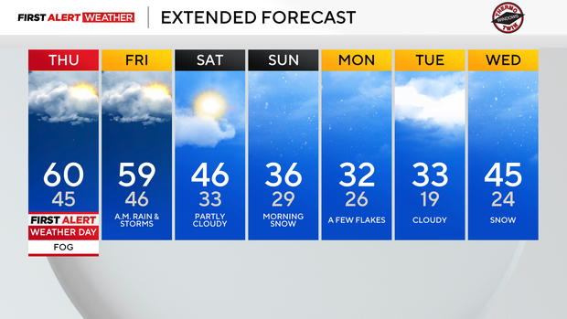
Temperatures could reach into the 60s in Pittsburgh, two rounds of rain also expected
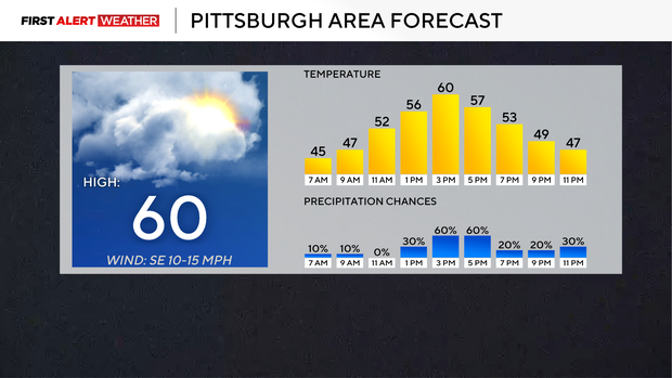
We have a chance to hit 60 degrees Thursday for the high in the Pittsburgh area. The last time we hit the 60-degree mark was on January 9, so we are due. I feel that with just how cold temperatures have been since then, the chance for hitting the 60-degree mark should be the headline over Thursday's rain chance and foggy start.
The other two will have an impact on your day, though, so let's get right into things.
WEATHER LINKS:
Current Conditions | School Closings & Delays | Submit Your Weather Photos
Similar to earlier this week, we are getting what is called 'advection fog'. Advection fog happens when you have warm air over a cold surface. With temperatures as cold as they've been, it is clear that the ground is cold.
Temperatures this morning are in the 40s, so we certainly have the 'warm' air in place. The other thing you need with advection fog is a moisture source, and while not a lot, yesterday's 0.01" of rain is acting as the moisture source. As the warm air interacts with the moisture and cools, we get fog.
While it doesn't seem that this morning's fog is going to be as bad as earlier this week, the same principle of 'why' we are getting the fog is in place. More advection fog is expected on Friday morning, but after that, we should get a break for around a week before it will be possible again.
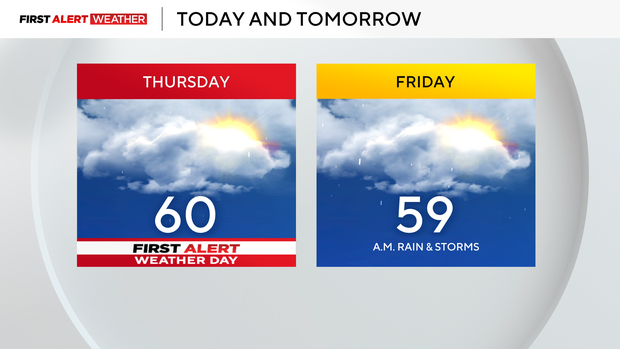
Rain showers will return this afternoon with a brief round of rain sliding by from 1 p.m. to 6 p.m. We will then get a brief break before our next round of rain, and storms roll through early Friday morning. Friday, similar to today, will be a busy weather day with windy conditions expected for the afternoon and a snow chance for places mainly north of I-80 for the late afternoon and evening hours.
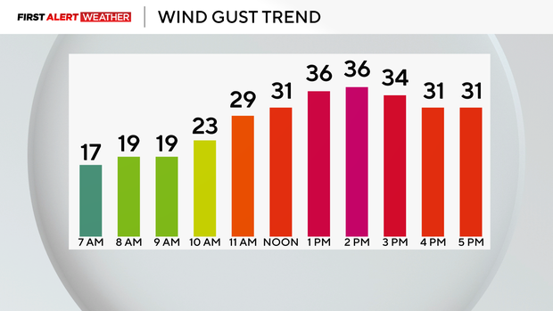
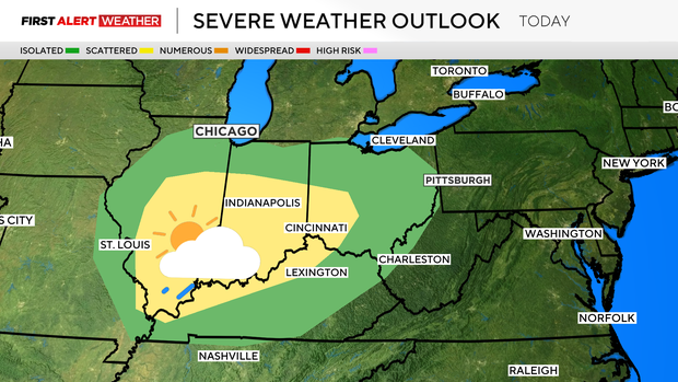
At this point, I can't rule out a renegade severe storm due to straight-line winds. The Storm Prediction Center has a small sliver of our coverage area on the daily severe weather risk map. Wind speeds are expected to be around 20 mph on Friday afternoon. Winds may gust up to 35 mph.
Temperatures rapidly cool down on Friday evening with much cooler weather in place for the weekend and early next week. We will also have a snow chance on Sunday. Data coming in is starting to gel more with a heavy snow band staying south of our area, but some accumulation on grassy areas is expected for us, and a dusting on hard surfaces. There is another chance for snow on Wednesday morning as warmer air moves back in.
Stay up to date with the KDKA Mobile App – which you can download here!