Following Thursday's powerful storms, more could be possible in Pittsburgh area on Friday | First Alert Weather

Widespread areas of 2 to 5 inches of rain occurred in a swath from eastern Ohio through Beaver and Washington counties, and east through Allegheny and Westmoreland counties, from three waves of powerful storms on Thursday evening.
Over two inches of rain at Pittsburgh International Airport on Thursday broke the record of 1.62 inches set in 1974. The annual surplus now sits at 7.68 inches and will continue to grow as more rain and storms move through the next 18 to 24 hours.
The current shortwave bringing scattered showers and storms will move out of the area by mid to late afternoon and evening. With areas from I-76 and points north seeing an abundance of cloud cover and light "stratiform rain," these locations will be less inclined to destabilize, so the severe risk is lower.
Any severe storms this afternoon should be confined primarily to our southwestern and southern counties. There is not much low-level shear or spin, but any storms that get near the boundary could develop some and produce pea- to quarter-sized hail and a low risk of a tornado along with damaging wind gusts.
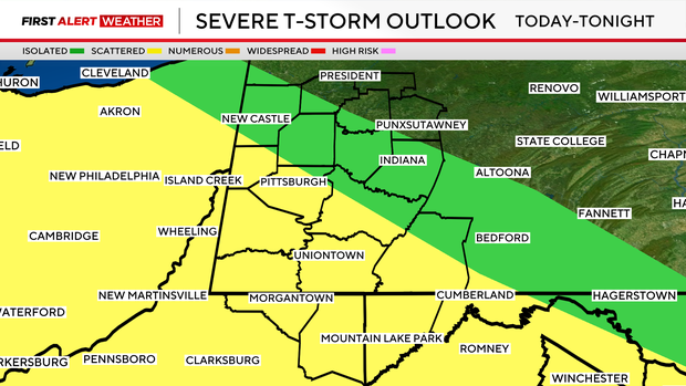
There will be a break from roughly 6 p.m. to around 10 p.m., then another shortwave will fire off storms this evening that will last overnight.
Damaging wind gusts and flash flooding will be possible with this overnight cluster — especially for places like Greene, Washington, Fayette, Monongalia, and Preston counties, which will have sufficient energy to support more robust storm updrafts.
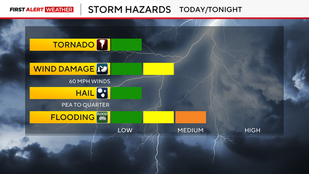
Additional rainfall amounts will range from 0.25 to 0.5 inches for most locations, with isolated amounts of 1 to 2-plus inches. This could easily lead to flash flooding.
The 1-hour flash flood guidance shows that most areas from Route 422 south into northern West Virginia only need less than 0.5 to 1 inch in 1 hour to induce flash flooding.
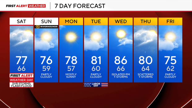
After some isolated to scattered storms on Saturday midday and early afternoon, drier air moves in during the evening following a cold front.
These dry conditions will linger through Labor Day and into Wednesday.