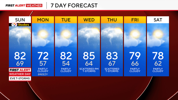
Isolated storms return to the Pittsburgh area on Sunday evening | First Alert Weather

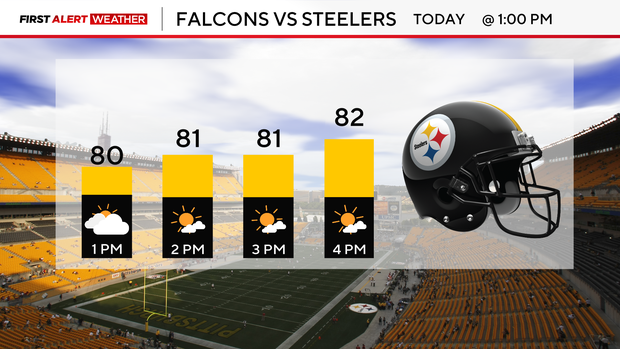
Today is a First Alert Weather Day, with decreasing clouds to start off our day and patchy fog, and highs in the low 80s with some sunshine for the Steelers game.
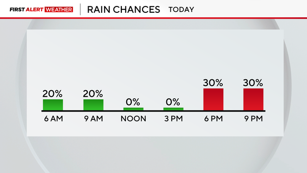
There's a small chance for an isolated thunderstorm in the evening, which could be severe. Much of the day is dry, but there will be some isolated areas that get a quick downpour, or in the evening that could trigger flash flooding, especially with all of the rain from yesterday; it won't take much.
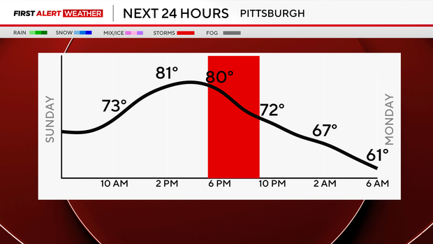
We are under a marginal risk (1 out of 5) for severe weather, so confidence is lower that storms will become severe, but still stay weather aware for outdoor events mainly north of Pittsburgh this evening.
After this weekend, Monday will be mostly sunny with highs in the low 70s, and comfortable! Tuesday will be back in the low 80s with sunshine and low humidity.
On Wednesday, the chance of storms returns in the evening with highs in the mid-80s. It'll stay unsettled for Thursday, with more thunderstorms possible before things quiet down for Friday and Saturday, as of right now.