The cooler temperatures in Pittsburgh continue on Thursday after the warmest April on record

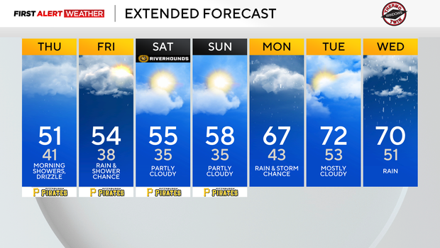
A lot of folks out there will feel the heat as heaters kick on today, Friday, or over the weekend. Cool weather settling in isn't going to keep rain away, as an upper low continues to push a couple of short waves our way. Each one of these waves will bring with it a chance for rain.
Today's rain chance peaks in the morning hours, with most rain falling before 10 a.m. I can't rule out rain after that, in the form of drizzle or sprinkles here and there.
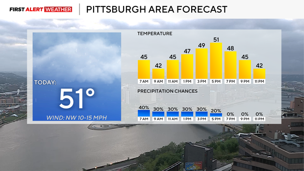
High temperatures today should struggle to make it back to the low 50s. I have Pittsburgh seeing a high of around 51°. Morning temperatures are in the mid-40s. Winds today should be out of the northwest at around 5 mph.
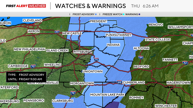
Cooler weather settles in overnight, with temperatures in most places dipping into the 30s. Frost advisories have been issued for spots on Friday morning due to the cooler air in place.
I have temperatures in the 30s on Friday, Saturday, and Sunday mornings. Saturday and Sunday will be colder than Friday morning and will likely see a mix of both frost advisories and freeze warnings being issued.
Highs today, Friday, and Saturday will just be in the 50s, a good 10-15 degrees cooler than the average high this time of the year.
Getting back to Friday's forecast, rain chances stick around with the best chance for rain happening late into the morning hours through the afternoon. Most rain should again come to an end around 6 p.m.
Warmer weather rolls back in early next week with highs in the 60s on Monday & in the 70s next Tuesday and Wednesday.
As we wrap up the month of April, it's already a sure thing that this April is going to be the warmest on record.
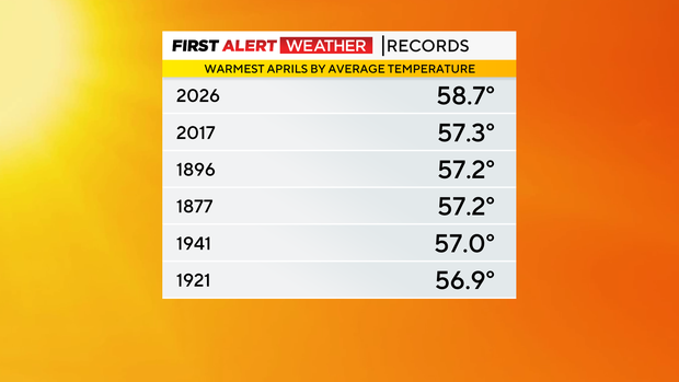
The only question at this point is the final temperature average. I have us at around 58.2° for the average temperature in April after today. The daily average temperature is calculated by adding the high and low for a day and then dividing the sum by two.