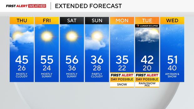
Pittsburgh will have cooler temperatures on Thursday, rain and snow possible this weekend
We are right at the start of a little bit of a lull when it comes to precipitation chances in Pittsburgh.
Our next chance for precipitation is late on Sunday with a brief round of snow that will mainly impact our area on Sunday morning. Currently, it appears that we may see a quick inch of snow falling, with little sticking around for more than an hour.
More snow is also expected on Monday.
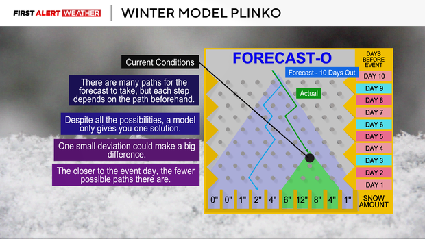
Yesterday, it was looking like the track of the heaviest snow was going to track right through our area. Model data now shows the track well south of our area, down in parts of West Virginia. We will still see some snow on Monday, and while there isn't a lot more time to see big track changes, some changes are still possible.
What continues to be the biggest concern over the next week is snow, rain, and freezing rain chances that model data has continued to be fairly consistent on for next Tuesday afternoon to early Wednesday morning.
Right now, it is still too early to know the breakdown of when and where snow, rain, and freezing rain will occur. We are monitoring and will get our details on timing, amount, and what you can expect as soon as we can.
Back to today's forecast.
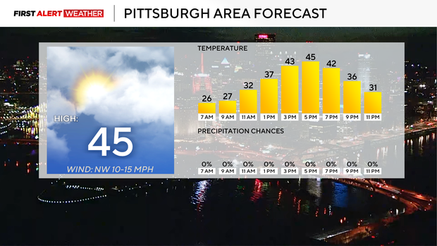
Highs today are only expected to hit the mid-40s. Noon temperatures will still be in the 30s. Winds will be light. Highs return to the 50s on Friday and Saturday.
We cool down Sunday through Tuesday with the snow chances I have already talked about sliding through.