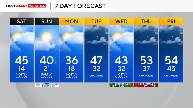
A cold start turns to warmer temperatures in the Pittsburgh area on Saturday
We are off to a cold start with lows in the teens and temperatures in the single digits for some.
WEATHER LINKS:
Current Conditions | School Closings & Delays | Submit Your Weather Photos
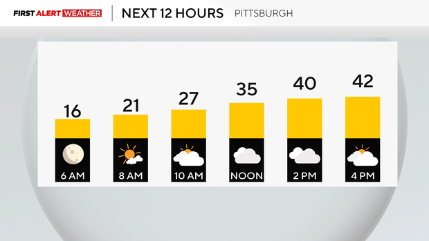
Today will be a dry, cloudy day, and snow on the ground will melt with highs warming up through the evening in the mid to upper 40s.
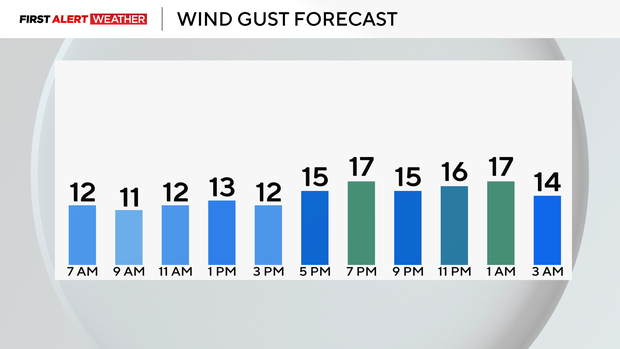
Winds will be around 15-20mph, making our temperatures feel like the 20s for some time. High pressure in place will keep things quiet this weekend.
Hourly Temperatures:
- 9 a.m.: 26° Mostly Cloudy
- Noon: 35° Cloudy
- 3 p.m.: 41° Mostly Cloudy
- 6 p.m.: 43° Mostly Cloudy
Our high on Sunday will be at midnight, right around 40, and then fall throughout the day.
Tomorrow is also the Winter Solstice, marking the first day of the Astronomical Winter!

Monday will be a chilly one with highs back in the upper 30s (near normal), and then we get back into the mid to upper 40s for Christmas Eve and then the 50s for Christmas day so unfortunately, it's not looking like a white Christmas but just a soggy one.
Stay up to date with the KDKA Mobile App – which you can download here!