The September Sizzle Is On
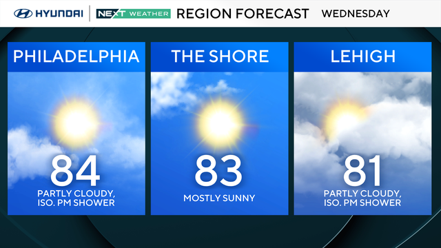
Yesterday was close to average with a high of 84, but highs today, tomorrow and Saturday surge back to around 90 with high humidity.
Watch CBS News
Yesterday was close to average with a high of 84, but highs today, tomorrow and Saturday surge back to around 90 with high humidity.

Overnight, the heavy rain will continue to push north through New Jersey, with showers and storms also moving through Philadelphia and surrounding suburbs as a cold front moves through.
Kate Bilo provides her weather blog in verse form.

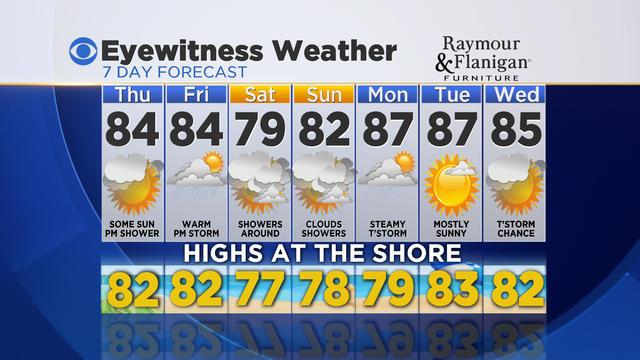
Another beautiful day in store tomorrow, with highs in the low 80's and lots of sunshine, and we should keep the sun for Thursday.

Tonight and tomorrow will feel downright autumnal for this time of year, with overnight lows in many spots diving into the 50's and highs tomorrow struggling to reach 80!

A lot was made about the Polar Vortex this past winter. It gained massive amounts of traction as a hashtag on Twitter and appeared in articles all over the web as a new phenomenon.

Severe thunderstorms will impact the area tonight, delivering a combination threat of severe wind gusts in excess of 60mph, very heavy localized downpours, and frequent cloud-to-ground lightning.
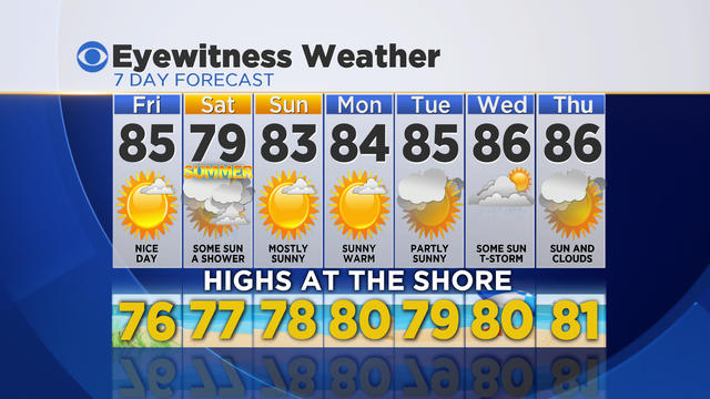
Showers have now cleared the region and cooler, less humid air is arriving. We'll enjoy a fabulous Friday with highs in the low to mid 80's and lower humidity.
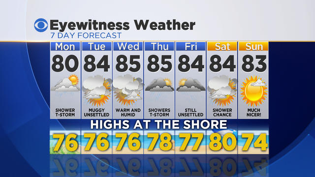
It's another round of flooding concerns Tuesday, with slow-moving, moisture-rich storms sprouting across the region.

We've had a string of lovely weekends in Philadelphia and this weekend continues that streak.

Once this storm is out of here, we clear out by the afternoon and then we've got a stretch of sunny, beautiful weather to look forward to right through the weekend, with highs in the 80's and lots of sunshine.

Once the sun popped out, it turned into a gorgeous Friday across the region!
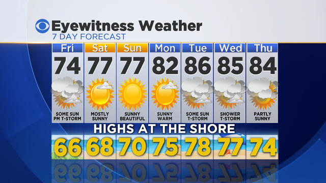
Today's chilly weather was brought to you by the east wind coming off the 59 degree Atlantic Ocean, and it felt more like early April than late May!
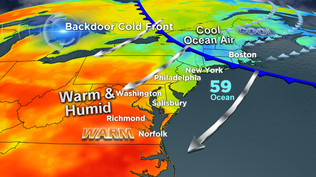
What a difference 24 hours can make! And it's all thanks to a weather phenomenon known as a "backdoor cold front."

Today's heat and humidity are feeding a line of strong to severe thunderstorms advancing through the region along a cold front.
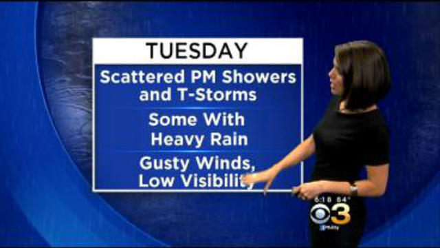
The summer warmth is living on borrowed time, as a cold front will move through Tuesday afternoon and evening.

The Memorial Day Weekend breakdown across the region.

An active pattern through the end of the week will eventually give way to a pleasant holiday weekend, with warming expected each day and increasing amounts of sunshine.

It will certainly feel warmer and steamier, but we also have the threat for showers and thunderstorms around through the afternoon. But these are just an appetizer, so to speak.
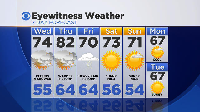
We'll head back to the 80's with sunshine on Thursday but once again, showers and storms are in the forecast - and then Friday ends up being a washout with heavy thunderstorms rolling through all day.

Clouds have been slow to break on this Friday, but you can feel the warmer air in place across the region - warmth that is poised to stick around into the weekend and next week!

It's been a tale of two days as we started out with sunshine and pleasant conditions and will finish on a cloudy, damp note as showers move through the area.

Flood waters continue to recede at this hour as today's dry, sunny weather has helped the area begin to recover from yesterday's devastating floods. Many of our area waterways charted Top 5 historic flood levels, and beat the numbers from our last major flooding disaster, Hurricane Irene in 2011.

The rain has been falling heavily all day, with many areas checking in with over two inches of rain.
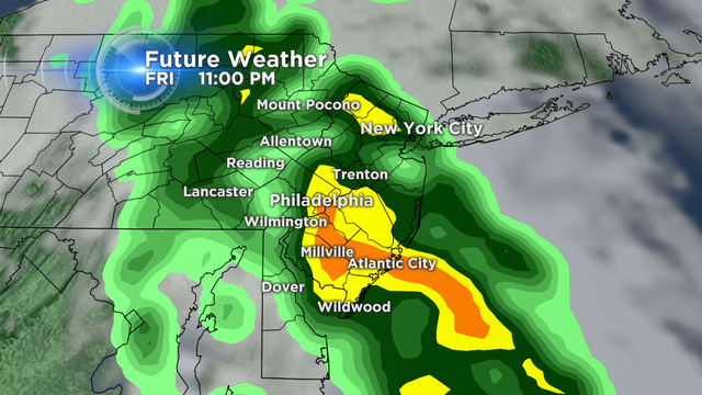
This storm is also producing dangerous thunderstorms to our south, across portions of North Carolina and Virginia, where tornadoes have been spotted. Luckily for us, the threat for severe weather will stay south, but we will hear a few rumbles of thunder tonight as the rain moves through.