Backyard BBQ: Delanco, N.J.
Justin Drabick takes the CBS 3 Mobile Weather Lab to Delanco, Burlington County for this edition of Backyard BBQ.
Watch CBS News
Justin Drabick takes the CBS 3 Mobile Weather Lab to Delanco, Burlington County for this edition of Backyard BBQ.

After setting a new record for the wettest month (12.97") in August for Philadelphia, a 3 day stretch of dry weather is finally in the forecast. Once again, heavy showers and thunderstorms caused flash flooding in parts of the Delaware Valley.

It was a comfortable start to the weekend, but now the heat and humidity have returned. Dew point temperatures, which measure the moisture content in the atmosphere, are very high right now in the low 70s.

Temperatures remained on the hot side this weekend with highs in the mid 90s but at least humidity levels remained low.

It's been a record breaking weekend as far as high temperatures go. Philadelphia set new records on Friday (103), Saturday (101), and Sunday (98) but the heat indices made it up to 115 at times.

After a warm but comfortable past few days, the weather pattern returns to a hot and humid pattern for the Delaware Valley. Today reached 90 degrees, day one of at least eight 90+ degree days in the forecast.

Justin Drabick has the mobile weather lab in Warminster, Bucks County for the latest Backyard BBQ.

The holiday weekend has remained hot with high temperatures in the upper 80s to around 90 so far. There will not be much change for the holiday itself as the heat continues. An approaching cold front tonight has triggered off some showers and thunderstorms across the region.


The last official weekend of spring brought temperatures above average in the mid to upper 80s. Humidity levels remain on the comfortable side through the weekend and will continue into the new workweek.

The past few days have been nice and comfortable temperature wise with highs in the upper 70s to low 80s. Humidity levels also have been low as a cooler air mass has settled into parts of the mid-Atlantic and Northeast.

Last year on Memorial Day we hit 93 degrees and it looks like we will do it again this year.
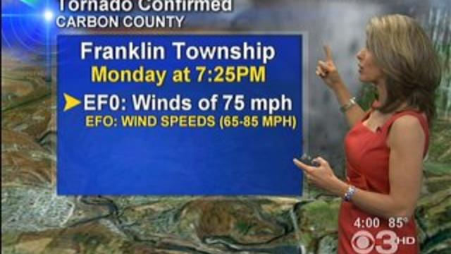
By Justin Drabick: In less than a week, another tornado touched down in the viewing area.

After the unsettled weather last week, the pattern has shifted to more summer-like for this week. Warm temperatures, humidity, and shower and storm chances return to the forecast this week.
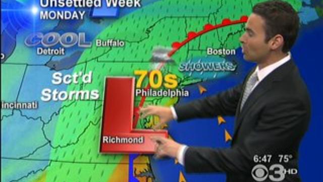
After being spoiled with some stellar weather last week, this week will be the opposite. A large upper-level storm system situated over the Ohio Valley is cut-off from the jet stream.
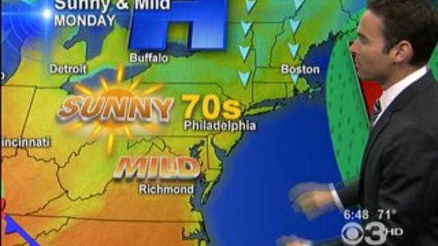
The upcoming days will be a good time to spend some time outside if you can. Some great May weather is on tap with sunshine and highs in the 70s.
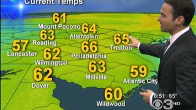
The overall weather pattern this weekend kept temperatures right where they should be for this time of year.

A cold front has stalled out north of the Delaware Valley allowing for a warm air mass to move into the region.


After a very warm day with highs in the low to mid 80s yesterday, temperatures have returned below average. A cold front which crossed the Delaware Valley this morning brought an end to the above average temperatures.
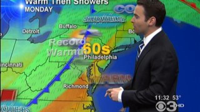
This will be the second Monday in a row where we have well above average high temperatures.

After a cool and soggy finish to the work week yesterday, the weekend is slowly improving.
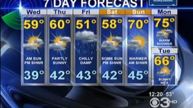
By Justin Drabick: Yesterday's cold front with spawned some strong thunderstorms with gusty winds ushered in a cold air mass behind it.

The recent cold weather pattern continues to break down allowing for temperatures to get back to average and even above average at times through the upcoming week.

It's not unheard of to have snow in April and some areas have a chance to see some tonight and tomorrow morning.