Consistent Spring Weather Ahead
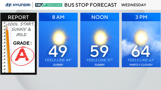
Our average high temperature for this time of year is in the low 60s, but will remain above average over the next five days. The forecast stays quiet for tonight and Thursday as high pressure controls our weather.
Watch CBS News
Our average high temperature for this time of year is in the low 60s, but will remain above average over the next five days. The forecast stays quiet for tonight and Thursday as high pressure controls our weather.

A low pressure system will continue to track into southern Canada today, allowing for drier weather to return.

Showers will continue at times this evening and overnight with some pockets of heavier rain possible along with cool temperatures holding in the lower 50s

After a stellar weekend with plenty of sunshine and highs close to average for this time of year, another storm will impact us on Monday.

We have had a nice start to the weekend with high temperatures just a few degrees below the average high of 60.
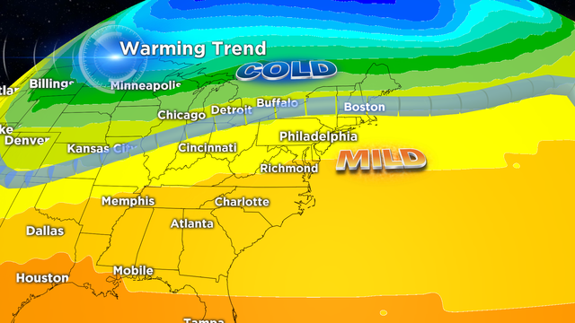
Another shift in the jet stream to the south has allowed a new supply of cold air to return to the Delaware Valley.

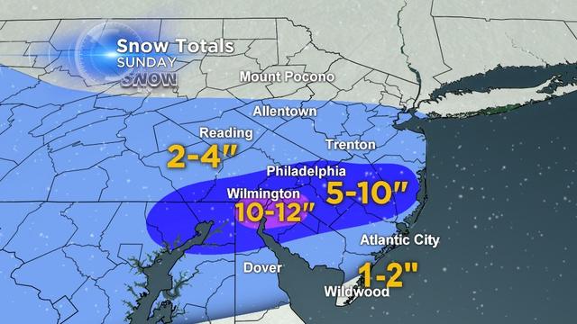
The heaviest snow will occur overnight through about 8am Monday morning.
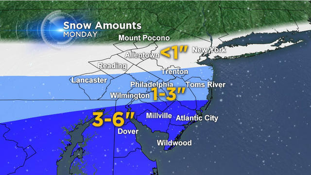
As of Saturday evening, far southern NJ and central and southern DE has the best chance to see the most snow of 3-6" with 1-3 inches around Philadelphia and surrounding suburbs.

The very cold arctic air will continue to push in from the north overnight as the 2nd round of heavier moisture moves in.

A classic late season winter storm is set to impact the Delaware Valley Sunday Night and Monday.

Expect light snow to develop before daybreak and end mid-late morning on Wednesday.

The cold high pressure system that brought the sunshine today across the Delaware Valley will keep the cold air locked in place tonight allowing for more snow.
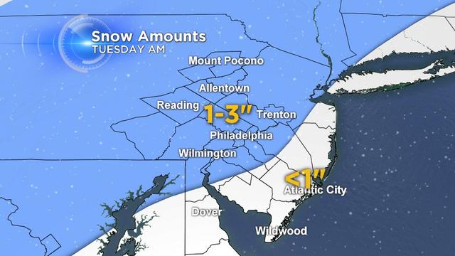
A weak storm system will move through early Tuesday morning bringing a round of snow.

Our latest round of snow has ended with amounts ending up as expected around 1-3 inches. Officially in Philadelphia, 0.6 inches was recorded, which puts us at 55.4 inches for the season and ties us for the number 3 spot for snowiest winters.
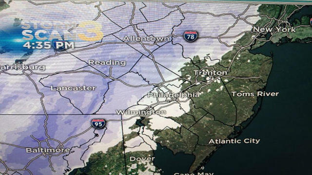
An arctic cold front moving through the Delaware Valley tonight continues to bring a period of steady snow.
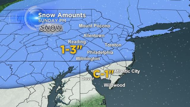
A few weak disturbances will move through providing some scattered snow shower chances overnight.

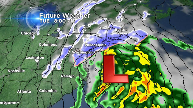
As moisture arrives overnight, temperatures will be warm enough for rain, then change over to snow as the colder air filters south and east.

An active weather pattern returns for three storms setting up to impact the region this week.
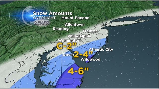
The core of the arctic air mass has settled into the Delaware valley today. It wasn't record cold but low temperatures did get down into the single digits in the suburbs and 12 degrees in Philadelphia.

Saturday's clipper system that dropped around 2" of snow across the region has bumped Philadelphia into the #4 slot for snowiest January.
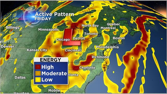
The first clipper will come through late Wednesday with another cold front with a chance of a rain or snow shower early Thursday morning.

The first winter storm of the new year remains on track to arrive in the Delaware Valley on Thursday evening.
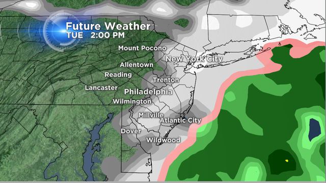
The storm has behaved as expected with the heaviest snow coming to an end early this afternoon.

The weather pattern remains very active and if you are a snow lover, you are loving the forecast.
A Winter Weather Advisory continues for the region into early Monday morning for sleet and freezing rain.