Hazy and humid weather in Philadelphia Thursday, air quality alert in effect from Canadian wildfire

We woke up to another hazy start across the Philadelphia area this morning, and if the sky looked a little milky or the sunrise had an orange tint, you're not imagining it.
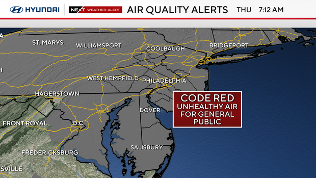
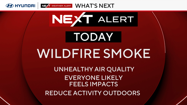
Thick wildfire smoke from ongoing fires across Canada has settled into the lower levels of the atmosphere, creating hazy skies and unhealthy air across the region. A Code Red Air Quality Alert means everyone should consider limiting prolonged outdoor activity, especially during the hottest part of the day.
Temperatures will climb into the lower 90s this afternoon, but with the humidity it will feel closer to 100 degrees. If you're spending time outside, stay hydrated, take frequent breaks, and if you notice the smell of smoke or begin experiencing irritation in your eyes or throat, it's a good idea to head indoors.
What to know about Canadian wildfire smoke in Philadelphia
As wildfire smoke continues to push into our region, Dr. Ruth McDermott-Levy, a professor at Villanova University and the co-director of the Mid-Atlantic Center for Children's Health and the Environment, said those with preexisting conditions should pay extra attention to the conditions outside.
"Wildfire smoke is among the most toxic air pollution we have," she said. "It burns whatever is in its path, so things that are not intended to burn are burned, and then also it travels very far so we're dealing with wildfire smoke from Canada. Along the way it picks up pollutants too."
McDermott-Levy said people might deal with a scratchy throat, itchy eyes and maybe a stuffy nose.
NEXT big weather changes
A NEXT Weather Alert remains in effect today for the combination of wildfire smoke and heat. A severe thunderstorm warning is in effect for Burlington County, New Jersey, until 5 p.m.
While the smoke should gradually thin out by Friday as winds shift, it will remain very warm and slightly less humid to end the workweek.
Our attention then turns to Saturday, when our next cold front arrives. As the front interacts with the hot and humid air mass in place, scattered thunderstorms are expected to develop during the afternoon and evening. Some storms could become strong to severe with damaging wind gusts, torrential rain and frequent lightning. Saturday has been placed under a NEXT Weather Alert while we continue to monitor the severe weather potential.
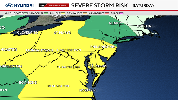
Behind the front, Sunday looks noticeably more comfortable with lower humidity, a mix of sun and clouds, and temperatures settling back into the 80s. It will be a much more pleasant finish to the weekend.
Here's your 7-day forecast:
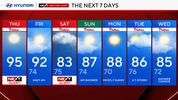
Thursday: NEXT Weather Alert for wildfire smoke. High 95.
Friday: Hazy morning. High 92, low 74.
Saturday: NEXT Weather Alert. High 83, low 75.
Sunday: AM shower. High 87, low 74.
Monday: Mostly sunny. High 88, low 70.
Tuesday: Thunderstorm. High 86, low 76.
Wednesday: Shower chance. High 85, low 72.


