Mostly cloudy, cool Wednesday in Philadelphia region. Here's the weather forecast.
We're finally getting a break from the rain today, but it certainly won't feel like much of a warmup.
Any leftover rain is mainly focused south and east this morning and continues to pull away. The rest of the day is largely dry, and we could even see some breaks of sunshine developing from north to south this afternoon.
So for most of the region, you can put the umbrella away after this morning and may actually want the sunglasses later. Outdoor plans are fine this afternoon, but the persistent northeast breeze will make it feel cooler than the thermometer suggests. A jacket is probably more useful than either.
The exception is the Shore, where this is not a beach day. Northeast winds are already gusting 30–35 mph and will strengthen, with rough surf building quickly. Stay out of the ocean, and if you're in a flood-prone coastal community, be prepared for water around the evening high-tide cycle.
NEXT big weather changes
The big story is the developing nor'easter, but there's an important distinction: this is already a significant coastal storm for the Shore, while impacts around Philadelphia remain much less certain.
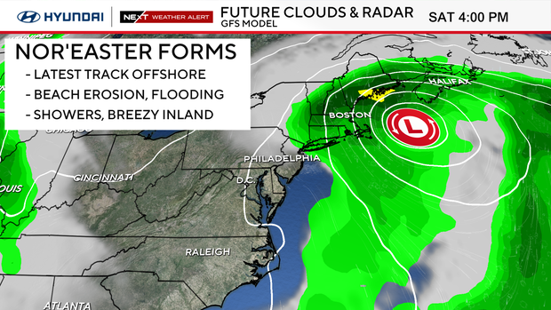
Strong high pressure parked to our north and developing low pressure offshore will keep us locked into a persistent northeast flow. That means the Jersey Shore and Delaware beaches take a pounding through several high-tide cycles, with coastal flooding, dangerous surf and beach erosion continuing through at least Friday and potentially into the weekend.
Thursday is actually pretty quiet inland: breezy, cool and mostly dry with clouds and some sun. Friday may even turn a little milder with highs into the lower 70s.
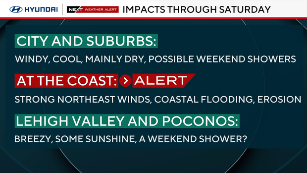
The bigger forecast question is Friday into the weekend. The coastal low strengthens offshore, and its eventual track determines whether Philadelphia gets pulled into a period of rain and stronger wind or whether the storm stays far enough east to keep our biggest impacts confined to the coast. That track is still not locked in, though the models have come into better consensus that a more offshore track is likely - which is better for us. That could still shift.
For now, I'd keep Saturday and Sunday somewhat flexible, especially for outdoor plans. Both days could turn wetter and windier if the storm comes closer, but a farther-east track would mean a much less impactful weekend inland.
Here's your 7-day forecast:
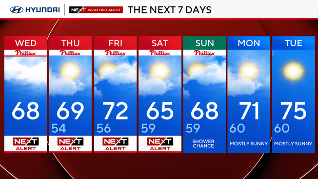
Wednesday: NEXT Weather Alert. High 68
Thursday: NEXT Weather Alert. High 69, Low 54.
Friday: NEXT Weather Alert. High 72, Low 56.
Saturday: NEXT Weather Alert. High 65, Low 59.
Sunday: Shower chance. High 68, Low 59.
Monday: Mostly sunny. High 71, Low 60.
Tuesday: Partly cloudy. High 75, Low 60.
Get the latest weather info on the CBS News Philadelphia app.


