Summer-like air hits Philadelphia region Monday with temps in 80s. Here's the weather forecast.
The last of the average temperature days are now behind us for the foreseeable future, with a huge push of summer-like air heading our way starting today.
With a front well to our north and a jet stream pattern that keeps us very warm and dry, we're going to start seeing winds increase out of the southwest between 20 and 25 mph, with a few higher gusts.
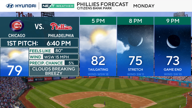
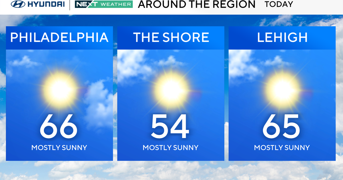
Monday is a very warm day, with highs in the 70s at the shore and around 82 degrees in the city.
NEXT big weather changes
We turn the temperature on high with a taste of summer. All this week our highs will be in the 80s and likely a few record highs in the 90s mid-week.
Along the Jersey Shore, expect cooler conditions due to the south winds crossing the much cooler ocean water adjacent to shore.
The week will mainly be dry with isolated chances for a shower or storm as the heat builds during the week.
Here's the 7-day forecast:
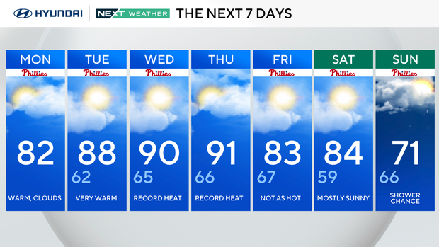
Monday: Warm. High 82, low 52.
Tuesday: Partly cloudy. High 87, low 62.
Wednesday: Record heat. High 90, low 66.
Thursday: Record heat. High 91, low 67.
Friday: Mostly sunny. High 84, low 66.
Saturday: Partly cloudy. High 86, low 58.
Sunday: Finally some rain? High 80, low 65.