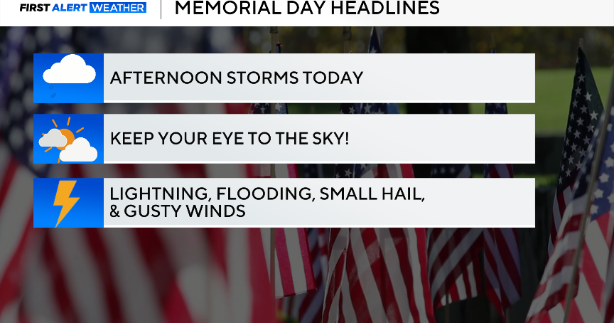
Spotty showers with breezy conditions, late-day storms possible in Philadelphia. Here's the forecast.

Much-needed rain showers will cross the Philadelphia area Saturday. It won't be an all-day washout, there will be breaks in the rain with a few scattered downpours. Plan on a gusty south wind Saturday and temperatures in the low to mid-70s (only 60s at the Jersey Shore).
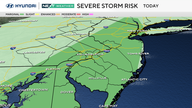
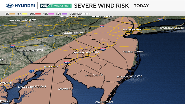
Breaks in the cloud cover later Saturday afternoon will allow the atmosphere to destabilize ahead of this storm system's cold front. Isolated thunderstorms are possible in the late afternoon through early evening. A few storms could briefly reach severe criteria and produce a damaging wind gust.
The rain ends by later Saturday evening, and skies will clear overnight as cooler and drier air arrives behind the front. The pressure gradient between Saturday's departing low and the high pressure arriving this evening will create 30-35 mph wind gusts from the northwest through Sunday.
Speaking of – Sunday will be breezy and more seasonable in the upper 60s. Skies will feature a mix of sun and clouds. By Monday, we head back to the upper 70s, and Tuesday, we reach the lower 80s.
A weak front drops through the region early Wednesday morning, and temperatures will top out in the upper 70s.
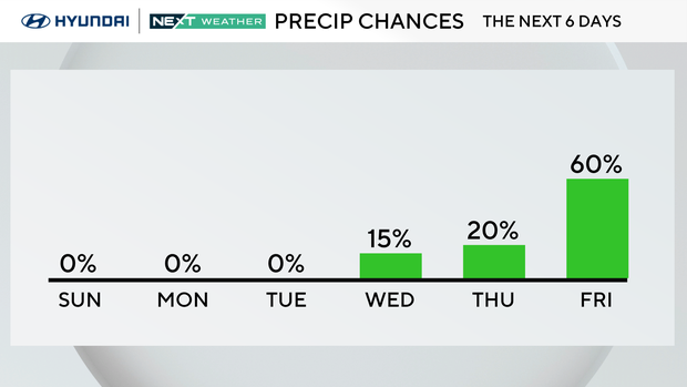
May begins on Thursday with partly cloudy skies and highs in the mid-70s. Friday is our next chance of rain.
Here's your 7-day forecast:
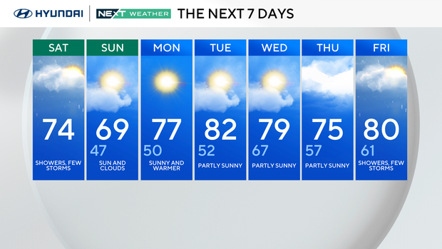
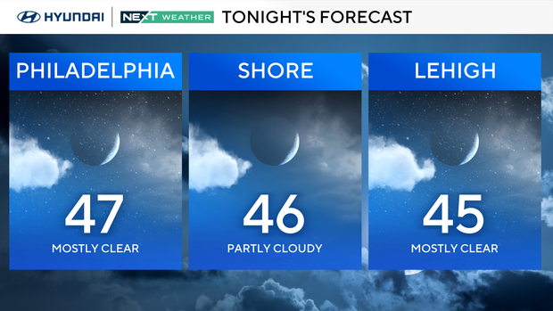
Saturday: Showers, a few storms. High of 74, low of 46.
Sunday: Sun and clouds. High of 69, low of 47.
Monday: Sunny and warmer. High of 77, low of 50.
Tuesday: Partly sunny. High of 82, low of 52.
Wednesday: Partly sunny. High of 79, low of 67.
Thursday: Partly sunny. High of 75, low of 57.
Friday: Showers, a few storms. High of 80, low of 61.
Get the latest weather info on the CBS News Philadelphia app.