Warm and muggy weather brings increased chance for thunderstorms in Philadelphia area. Here's the forecast.

Sunday remains warm and humid with a mix of clouds and some sunshine in the Philadelphia area. While an isolated shower or thunderstorm can't be ruled out in the afternoon, the better chance for widespread rain holds off until Sunday night.
Overnight, showers and thunderstorms become more numerous as a slow-moving system approaches the Delaware Valley.
A flood watch is in effect from 8 p.m. Sunday through Monday evening in these areas:
- New Castle County, Delaware
- Camden, Eastern Monmouth, Gloucester, Hunterdon, Mercer, Middlesex, Morris, Northwestern Burlington, Salem, Somerset, Sussex, Warren and Western Monmouth counties in New Jersey
- Berks, Delaware, Eastern Chester, Eastern Montgomery, Lehigh, Lower Bucks, Northampton, Philadelphia, Upper Bucks, Western Chester and Western Montgomery counties in Pennsylvania
Rain could fall at 1 to 3 inches per hour with localized showers bringing up to 3 to 5 inches per hour, which could cause flash flooding, according to the National Weather Service.
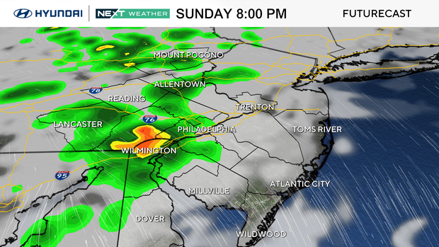
NEXT big weather changes
Monday brings the most active weather of the next several days. Multiple rounds of showers and thunderstorms are expected from morning through the evening, fueled by deep tropical moisture.
While it won't pour all day, any one of these showers and storms may produce heavy rainfall, and we'll keep an eye on the threat for localized flooding. Some improvements are likely later in the afternoon.
The unsettled pattern doesn't end Monday. Additional showers and thunderstorms remain in the forecast through much of the upcoming week as a slow-moving front lingers nearby.
Tuesday looks to bring us the best chance to stay dry and as of now, looks like our pick of the week. We may have a few days in the 90s by later in the work week, meaning another heat wave is on the table.
Here's your 7-day forecast:
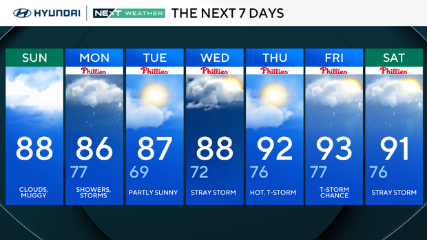
Sunday: Clouds, muggy. High 86, Low 75
Monday: Showers, storms. High 84, Low 77
Tuesday: Partly sunny. High 87, Low 71
Wednesday: Stray storm. High 87, Low 72
Thursday: Hot, thunderstorm. High 92, Low 76
Friday: Thunderstorm chance. High 91, Low 77
Saturday: Stray storm. High 91, Low 76


