Warmer than average spring temperatures in Philadelphia area before storm chances. Here's the weather forecast
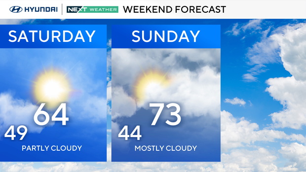
This first weekend of spring will not disappoint! We'll have mostly sunny weather on Saturday in the Philadelphia area with highs in the upper 50s to low 60s.
Sunday is even warmer, with highs 20 degrees above average in the low 70s. Partly cloudy skies will turn cloudy late in the day.
By Sunday evening, several rounds of gusty to strong storms develop, impacting us Sunday night into Monday morning.
NEXT big weather change
A severe threat Sunday evening through Monday morning is our Next Big Change. A clipper type system will pull a strong cold front across the region.
As a cold front drops south into the area, there will be several waves of showers and storms between 8 p.m. Sunday through – 8 a.m. Monday.
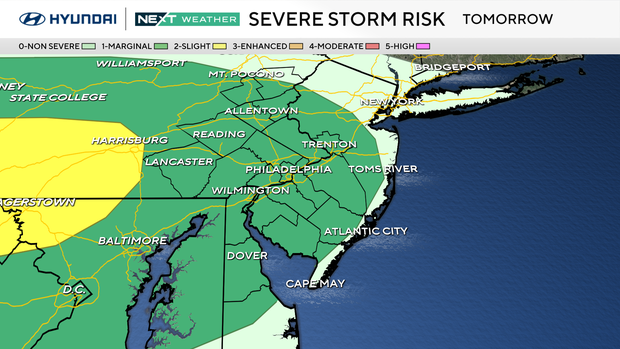
A few strong to severe storms could develop with heavy rain, hail, and isolated damaging winds. The tornado threat is currently low.
Our NEXT Weather team is monitoring the storm risk on Sunday evening. It's currently at a Level 1 severe risk west of the city but that may shift east.
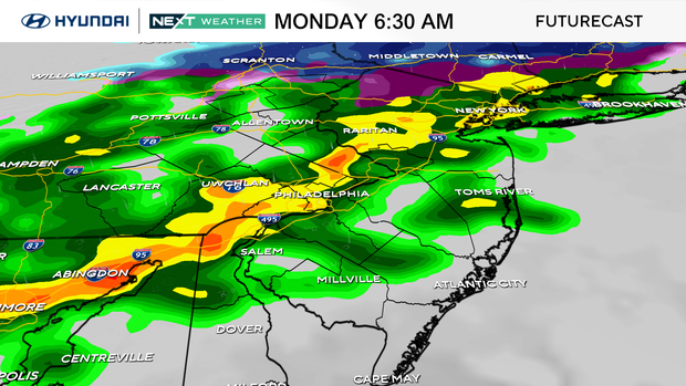
The impacts we could see include localized flash flooding, scattered power outages and wet roads that could make your commute longer on Monday morning.
Behind the cold front, we drop 20 degrees to the low 50s Monday and Tuesday.
Conditions will improve for the Philadelphia Phillies' season opener on Thursday at Citizens Bank Park. It should be in the mid-60s for the first pitch at 4:15 p.m., with rain chances later that night.
Here's your 7-day forecast:
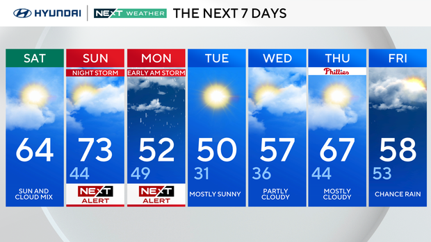
Saturday: Partly sunny. High 64.
Sunday: Nice and warm. High 73, low 44.
Monday: Morning rain to sun. High 52, low 49.
Tuesday: Chilly. High 50, low 31.
Wednesday: Mostly cloudy. High 57, low 36.
Thursday: Mostly sunny. High 67, low 44.
Friday: Shower chance. High 58, low 53.


