Rainy Wednesday in Philadelphia before temperatures swing upward. Here's the weather forecast.
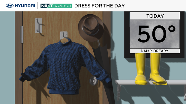
Wednesday brings slightly milder weather to the Philadelphia region, but it won't be a nice day to spend outside. Keep the umbrella close since more widespread, on-and-off showers are expected through the afternoon.
On the plus side, you'll only need a light jacket, as temperatures climb to the 40s and 50s.
NEXT big change
The spring-like weather pattern continues this week with warmer weather, but rain chances every day through Friday.
A dense fog advisory is in effect Wednesday night into Thursday morning in the coastal areas of New Jersey and Delaware. Visibility could be low — less than a mile — and it could make driving hazardous. Be sure to put your headlights on (not your highbeams), don't follow too closely on the highway and allow extra travel time.
This weather alert takes effect at 6 p.m. Wednesday and will expire at 10 a.m. Thursday.
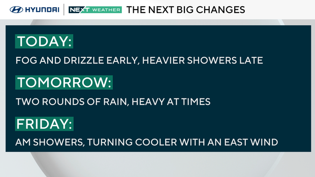
We're in the battleground area between warmth to the south and cold air to the north, and several disturbances will ride along the boundary over the next few days.
The heaviest rain will come Thursday morning and again Thursday night.
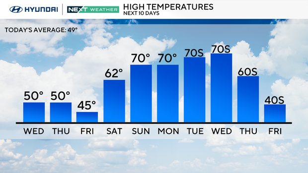
Saturday will be a transition day, so it'll depend on how much sun we'll see. Some spots will make a run for temperatures in the 60s.
Then a big warmup comes Sunday with highs near 70. And it's looking even warmer by Tuesday and Wednesday.
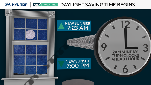
Daylight Saving Time
Prepare to spring forward! Daylight Saving Time begins on Sunday, March 8. Set your clocks ahead 1 hour at 2 a.m. Sunday.
Here's your 7-day forecast:
Wednesday: Showers. High 54, Low 39
Thursday: AM showers. High 53, Low 43
Friday: Cooler. High 50, Low 41
Saturday: Some sun. High 62, Low 39
Sunday: Nice and mild. High 70, Low 56
Monday: Very warm. High 72, Low 49
Tuesday: Staying nice. High 73, Low 49


