Philadelphia Weather: Tracking Stronger Thunderstorms This Afternoon
PHILADELPHIA (CBS) - Those days of comfortable, cool temperatures are behind us. Get ready for a Wednesday warm-up. It's going to be a return to hot and humid conditions with the chance for some scattered thunderstorms today.
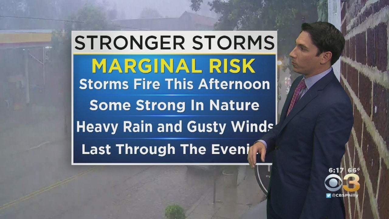
Although the summer conditions are making a comeback, CBS3 meteorologist Matt Peterson says we could see some stronger thunderstorms roll into the area later this afternoon and evening. Our chances for severe weather are relatively low but some locally heavy rain, gusty winds, and isolated flash flooding are still a possibility.
The western suburbs could start to see thunderstorm activity pop up after 3 p.m. Wednesday. Philadelphia and the immediate suburbs of New Jersey and Pennsylvania can expect thunderstorms to start around 6 p.m., which could lead to an increase in traffic during your commute home.
As the front continues to move through our region, it will be warm and humid on Thursday. This weekend will be mostly sunny and warm beginning on Friday.
TODAY -- Increasing Clouds, Thunderstorms Develop This Afternoon, Could Produce Heavy Rain and Gusty Winds. High 86
TONIGHT -- Overcast with Thunderstorms Possible. Low 69
TOMORROW -- Partly Cloudy, Scattered Showers with Isolated Thunderstorms Possible. High 85
Stay up-to-date on the latest forecast with the CBS Philly Weather App.
CBS3 weather intern Sloane Haines contributed to this report.