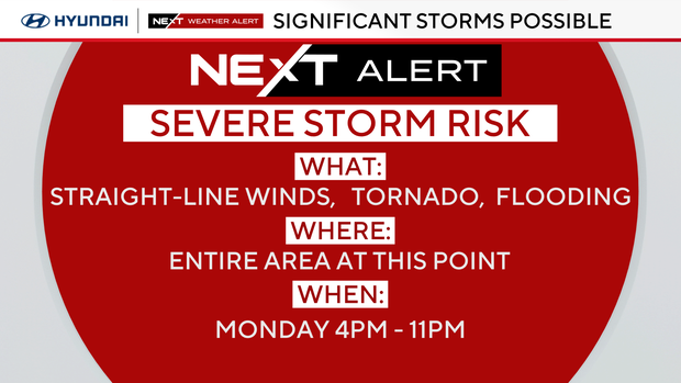
Strong storms roll through Philadelphia area, bringing heavy rain and wind. Here's the weather forecast
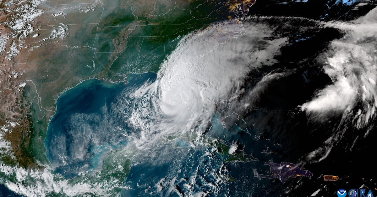
Strong storms brought heavy rain and wind to the Philadelphia area Monday night.
Tornado warnings for parts of Burlington, Ocean and Monmouth counties in New Jersey and Kent County, Delaware, have ended after strong storms passed through the region.
Thousands of customers lost power Monday night.
A widespread wind advisory remains in effect until 2 a.m. Tuesday morning. A gust of wind, independent of any storm, could bring winds up to 30 to 40 mph, even higher in spots, so it wouldn't take much for a thunderstorm to become severe.
What is the difference between a tornado watch and warning?
A tornado watch means the conditions are favorable for a tornado to form, such as possible rotation in the atmosphere.
A tornado watch is issued when severe thunderstorms (thunderstorms that have winds of 58 mph or higher and/or produce hail 1 inch in diameter or larger) and tornadoes are possible in and near the designated watch zone, according to the National Weather Service.
This does not mean a tornado will occur; rather, people should watch out because one could happen. A watch means people in the affected area should be on the lookout for further developments, like a tornado warning.
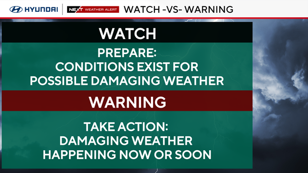
A tornado warning is the next step.
This warning means a tornado has been spotted or detected on weather radar, and people in the affected area should take shelter. According to the NWS, a tornado warning is issued when a tornado is imminent.
The NWS has an extensive list of tornado safety tips available on its website.
Tuesday weather alert
A big temperature drop follows on Tuesday, aka St. Patrick's Day. It'll be a bitterly cold start with lows near or slightly below freezing and wind chills in the mid-20s Tuesday morning.
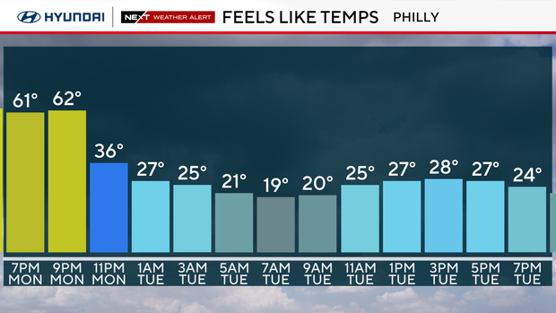
Highs Tuesday afternoon will struggle to climb into the low 40s.
Here's your 7-day forecast:
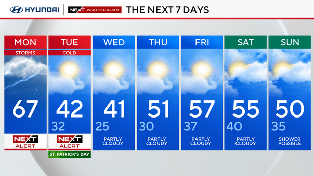
Monday: NEXT Weather Alert for Storms. High 67, low 47.
Tuesday: NEXT Weather Alert for cold. High 42, low 32.
Wednesday: Partly cloudy. High 41, low 25.
Thursday: Partly cloudy. High 51, low 30.
Friday: Mostly sunny. High 57, low 37.
Saturday: Clouds, some sun. High 55, low 40.
Sunday: Maybe a shower? High 50, low 35.