Flood watch in effect for parts of South Jersey as storms move through Philadelphia region Thursday night

Parts of South Jersey are under a flood watch until midnight Thursday as the Philadelphia region deals with more rain.
Heavy rain developed on Thursday, with Philadelphia International Airport reporting a record rainfall of 2.40 inches so far, according to the National Weather Service. The previous record was 1.79 inches, set in 1952.
The flood watch is in effect in Atlantic and Cumberland counties.
The entire Philadelphia area is also under a severe thunderstorm watch until 10 p.m.
Through the afternoon, however, a little more widespread showers and thunderstorms will develop and work across the region, especially from the Philadelphia area and points south.
We issued a NEXT Weather Alert due to the threat that some of these storms will be capable of producing damaging winds and heavy rain that may result in flash flooding. The storms will move east and off the coast.
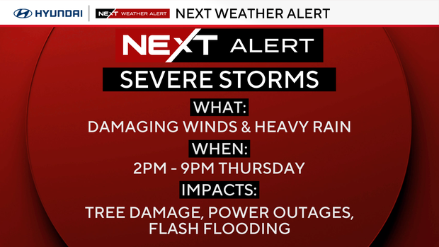
Storms could dump 1-2 inches of rain in a short period, but the greatest threat with these storms is the damaging winds.
Hundreds of flights impacted by storms at PHL Airport
Storms are having a big impact on flights in and out of Philadelphia International Airport on Thursday. According to the flight tracking site FlightAware, more than 300 flights are delayed as of 3:45 p.m., and nearly 70 have been canceled.
Travelers are urged to check with their airlines for the latest flight information.
NEXT big weather changes
Another chance for a few afternoon showers or storms will develop Friday afternoon, but the coverage and intensity of the storms should be less than today's. A small chance for a few showers may linger into early Saturday morning, but the current trend is to clear out the rain for most of the day Saturday.
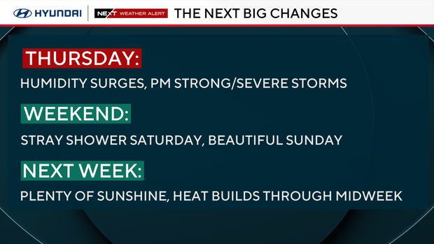
By Sunday, the chance of rain drops to near zero, allowing for partly cloudy skies and high temperatures in the mid-upper 80s.
Next week is already advertising the return of the heat with another potential heat wave in the works with high temperatures back in the middle and possibly upper 90s by the middle of the week.
Here's your 7-day forecast:
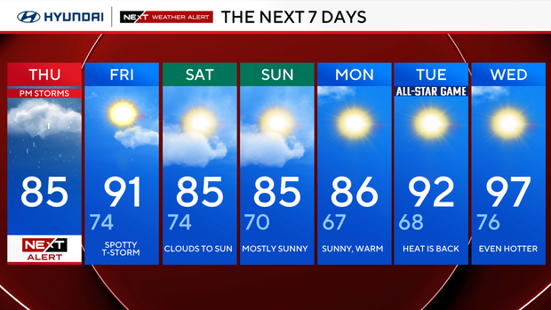
Thursday: NEXT Weather Alert. High 85,
Friday: A few showers. High 91, low 74.
Saturday: Decreasing clouds. High 85, low 74.
Sunday: Mostly sunny. High 85, low 70.
Monday: Bright skies. High 86, low 66.
Tuesday: Heating up (MLB All-Star Game). High 92, low 68.
Wednesday: Heat wave. High 97, low 76.


