Nice start to the week in the Philadelphia area with a taste of fall. Here's the weather forecast.

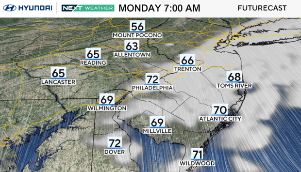
A taste of fall weather is returning to the Philadelphia area, as partly cloudy skies and muggy conditions give way to sunshine by Monday afternoon.
High temperatures are in the upper 70s with a gusty northwest breeze, a touch below our average high of 80 degrees. This cooler and much drier air arrives with high pressure from Canada.
Light winds and dry conditions will be the norm for everyone as we begin the new week.
NEXT big weather changes
Monday night turns cool with 50s around the city and some 40s in our coolest suburbs.
Conditions stay sunny and dry Tuesday through Thursday with a gradual warming trend back into the 80s.
Our normal this time of year is 80. Daytime highs in the 70s are a little below average.
And then, déjà vu, humidity returns to end the week, along with a front that brings a small shower chance Thursday night into Friday.
After all, it is still summer for nine more days.
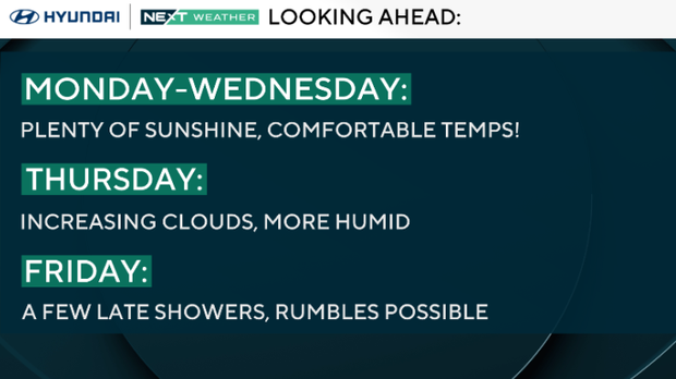
Saturday looks like the better weekend day right now, with our next better opportunity for rain arriving Sunday into Monday.
Here's your 7-day forecast:
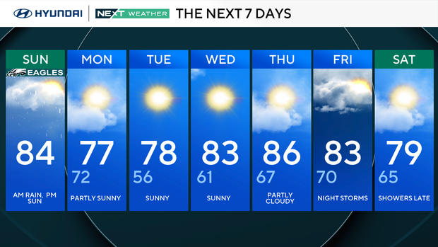
Monday: More afternoon sun. High 77, Low 72
Tuesday: Sunny. High 78, Low 56
Wednesday: Sunny. High 83, Low 61
Thursday: Partly cloudy. High 86, Low 67
Friday: Late rain/storms. High 83, Low 70
Saturday: A shower or two. High 79, Low 65
Sunday: Scattered showers. High 78, Low 68.
Get the latest weather info on the CBS News Philadelphia app.


