Quiet Tuesday in Philadelphia, tracking rain later this week. Here's the weather forecast.
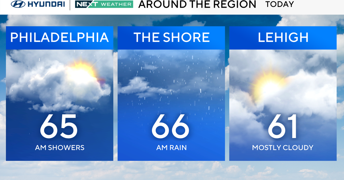
Tuesday will be another relatively quiet day in the Philadelphia area, similar to Monday, with some added cloud cover filling in later in the day.
A storm system will pass by to our south but have little to no impact locally beyond the increase in cloud cover and a few shower chances later Tuesday into the night along the coast.
A chilly breeze will be picking up from the northeast Tuesday and into Wednesday with gusts to 25 mph.
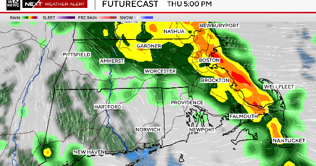
The next impactful storm we are watching will arrive Wednesday night and bring widespread impacts to our area Thursday in the form of wind and rain.
Winds will pick up near the shore, gusting up to 30 or 35 mph and move across the entire Delaware Valley. The rainfall totals will likely end up in the 1-3 inches range, spread over the course of 6-12 hours.
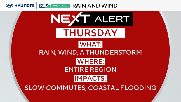
Because of the extended period, flash flooding isn't likely, but certainly bears watching. Ponding and localized urban flooding are also possibilities.
Halloween weather forecast preview for the Philadelphia area
Looking ahead, the storm system should be out of our area by Friday, opening the door to cooler conditions but dry on Halloween night.
Not the 80s like we had last year, but not stormy either. That dry weather will likely stay through the weekend.
Timeline for Hurricane Melissa's movements in Jamaica
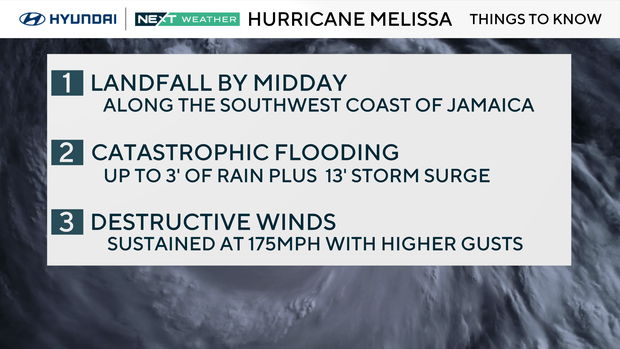
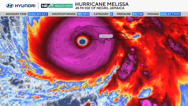
Meanwhile, Hurricane Melissa makes landfall Tuesday along the southwest coast of Jamaica as a monstrous Category 5 hurricane. Just prior to landfall, the central pressure dropped to 982 millibars with sustained winds of 185 mph, meaning Melissa has tied for the third strongest storm on record pressure-wise in the Atlantic basin, and second for strongest sustained winds in the Atlantic basin.
Only six storms in the Atlantic previously have dropped below 900 mb, with the strongest being Wilma in 2005, which had a central pressure of 882 mb. It's also important to note that these are the stats at landfall, while other storms achieved this status over open water. These stats at landfall would tie with the 1935 Labor Day hurricane as the strongest to come on shore.
The storm is moving slowly north and will cross Jamaica throughout the day. Catastrophic flash flooding, landslides and a storm surge up to 13 feet are likely along Jamaica's southern coast, as well as catastrophic winds gusting over 200 mph. Heavy rain will also spread into southern Hispaniola and eastern Cuba, where flooding and destructive surf are expected through midweek.
Melissa is expected to make a second landfall overnight Tuesday into Wednesday morning along the southeast coast of Cuba as a Category 4 major hurricane and then cross the Bahamas before setting its sights on Bermuda, potentially making landfall three or four times.
Irma, notably, made five landfalls as a major hurricane, but it's not common for storms to make multiple landfalls while maintaining intensity.
Stay with your NEXT Weather team for the latest.
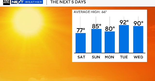
Here's your 7-day forecast:
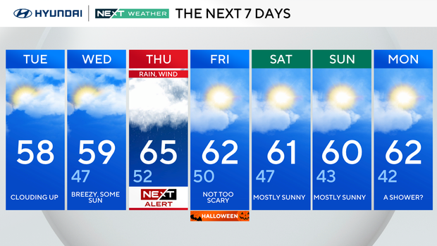
Tuesday: Clouding up. High 58, Low 47.
Wednesday: Breezy, some sun. High 59, Low of 47.
Thursday: NEXT Weather Alert for rain and wind. High 65, Low 52.
Friday/Halloween: Not too scary. High 62, Low 50.
Saturday: Mostly sunny. High 61, Low 47.
Sunday: Mostly sunny. High 60, Low 43.
Monday: A shower? High 62, Low 42.