Not as cold Thursday in Philadelphia region, spring officially arrives Friday. Here's the weather forecast.
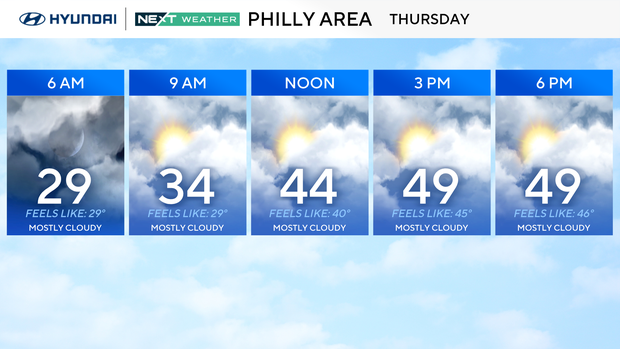
After a cold start to the morning again, with many areas in the 20s and wind chills in the teens, we will finally get back to normal highs in the low 50s around most of the Philadelphia region Thursday.
Partly cloudy skies will allow you to change from the heavy coat to the sweatshirt by the afternoon. Umbrellas will not be needed as our next rain maker isn't until Friday evening. Winds will be fairly light as well, gusting to 15mph.
NEXT big weather changes
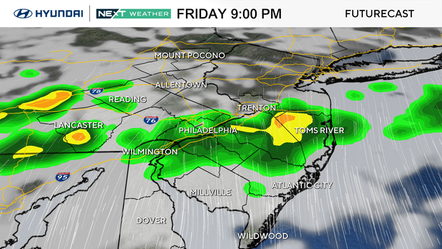
Temps will continue to warm this week, and we'll be tracking a few non-impactful rain chances. Our next best chance looks to be overnight Friday into Saturday morning, but it should clear out and warm up Saturday afternoon with highs climbing into the low 60s.
By Sunday, it'll feel pretty warm, close to 70 for a lot of the area, before another front brings showers Sunday night. Then, it cools back down on Monday, and by Tuesday, it turns colder again with below-normal temps returning.
Spring officially begins Friday with the vernal equinox at 10:46 a.m.
Here's your 7-day forecast:
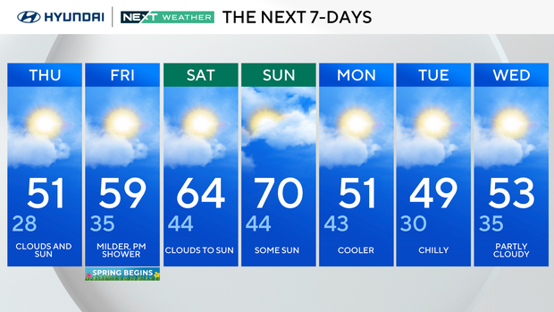
Thursday: Clouds and sun. High 51, low 28.
Friday: Milder, p.m. shower as spring begins. High 59, low 35.
Saturday: Clouds to sun. High 64, low 44.
Sunday: Some sun. High 70, low 44.
Monday: Cooler. High 51, low 43.
Tuesday: Chilly. High 49, low 30.
Wednesday: Partly cloudy. High 53, low 35