Temps plummet Thursday in Philadelphia region after overnight rain showers. Here's the weather forecast.
After some early morning rain, skies will gradually clear heading into Thursday afternoon in the Philadelphia region.
Precipitation will be over by the time the Thursday morning commute gets underway, but temperatures will rapidly fall below freezing, meaning we could see some icy spots, especially in the northwest.
Expect temperatures to plummet throughout the day, with winds gusting as high as 30 mph from the northwest.
NEXT big weather change
Temperatures quickly drop below freezing, with feels-like temps in the teens and 20s by late afternoon/evening. Tomorrow morning we will wake up to wind chills in the single digits.
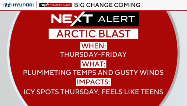
Behind the cold front, some sun will return for the end of the week, but bitterly cold temperatures pour in. Highs both Thursday and Friday will be in the 30s; barely above freezing in many spots, with a gusty wind making temperatures feel like the single digits and teens by Friday morning.
Because of this, a NEXT WEATHER ALERT has been issued for both days due to this Arctic blast.
A second reinforcing cold shot arrives Sunday, and a third next Tuesday will bring the coldest air of the season so far. Highs will only be in the 20s Tuesday with morning wind chills likely near zero in many spots. We've gone ahead and issued a NEXT Weather Alert for Tuesday because of this extreme cold.
Here's your 7-day forecast:
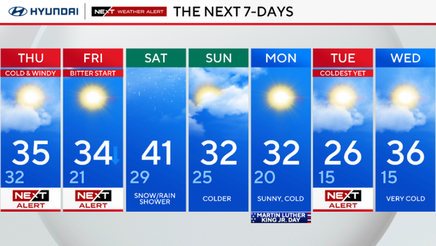
Thursday: NEXT Weather Alert, cold and windy. High 35, low 32.
Friday: NEXT Weather Alert, bitter start. High 34, low 21.
Saturday: Snow shower/rain. High 41, low 29.
Sunday: Colder. High 32, low 25.
Monday/MLK Day: Sunny cold. High 32, low 20.
Tuesday: NEXT Weather Alert for the coldest weather of the season. Very cold. High 26, low 15.
Wednesday: Very cold. High 36, low 15.