Philadelphia sees another day near 80 degrees on Tuesday as sunny, mild stretch continues

Showers ahead of a cold front will be scattered across the region overnight Monday into very early Tuesday morning, but by sunrise, the front will clear the coast, taking with it all the rain.
Temperatures on Tuesday morning will only drop into the mid-upper 50s as the winds shift to the west, compared to the cooler flow out of the southeast off the Atlantic that the Philadelphia area experienced all day Monday.
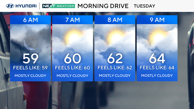
This westerly flow will usher in drier and warmer conditions, sending temperatures into the mid-upper 70s Tuesday afternoon under increasing sunshine. A westerly breeze from 5-15 mph will complement the unseasonable warmth.
Even though Tuesday afternoon will be relatively warm, under mostly clear skies and calming winds, temperatures Tuesday night will cool off rather efficiently as low temperatures settle in the low-middle 50s.
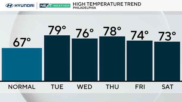
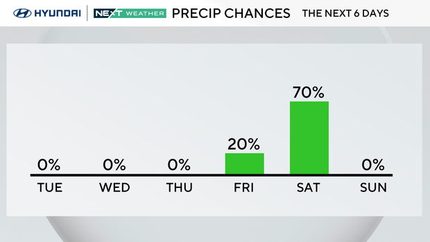
The sunny and mild stretch continues into Friday with highs in the mid-to-upper 70s. A stray shower is possible Friday night, but our next best chance for rain comes on Saturday when our next cold front moves through with the chance of showers and storms.
Our NEXT Weather team will keep you posted on the exact timing as we get closer to the weekend.
Here's your 7-day forecast:
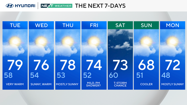
Tuesday: Very warm. High of 79, low of 58.
Wednesday: Sunny, warm. High of 76, low of 54.
Thursday: Mostly sunny. High of 78, low of 53.
Friday: Mild, p.m. shower? High of 74, low of 52.
Saturday: Thunderstorm chance. High of 73, low of 60.
Sunday: Cooler. High of 68, low of 51.
Monday: Mostly sunny. High of 72, low of 48
Get the latest weather info on the CBS News Philadelphia app.