Another round of strong storms expected to hit Philadelphia region Wednesday. Here's the weather forecast.

The Philadelphia region is under another NEXT Weather Alert on Wednesday for the potential for another round of strong storms, mainly later in the evening into the overnight hours Thursday.
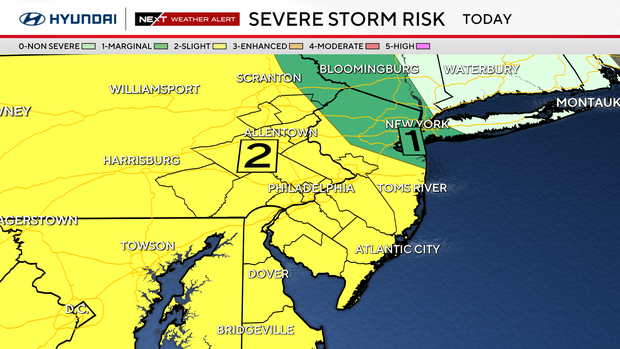
Damaging winds and heavy rain will be the most significant impacts in the region, although large hail and an isolated tornado threat exist, mainly west of Philadelphia.
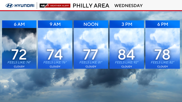
Conditions are much calmer Wednesday morning, but still damp, with areas of light mist and fog. Skies will remain mostly cloudy with mainly dry conditions through the majority of the day.
While it will be another shorts-and-T-shirt day, it will not be as oppressively hot as it was Tuesday, when feels-like temperatures exceeded 100 degrees. Highs will be in the low 80s.
NEXT big weather changes
A frontal boundary will remain draped over the region that will be the focus for more storms in the evening and overnight hours.
Once again, these storms will have the potential to turn severe, with damaging winds and heavy rain being the primary concerns.
The Storm Prediction Center has placed our region under a Level 2 or "slight" risk for severe weather. The greatest risk for severe weather will be across central PA, but a few stronger storms will damaging winds and heavy rain could make it into our region.
The cold front will start to push to the south Thursday, but it likely won't clear the area completely before more storms begin to develop Thursday afternoon. We'll have to watch again for the threat of some strong-to-severe weather later in the day.
By Friday, drier and more stable air will begin to push into the region. It will start to lower the humidity and bring back the sunshine.
High temperatures Friday will be in the mid-upper 80s, but into the Labor Day weekend, high temps will be around 80 degrees under mostly sunny to partly cloudy skies.
Here's your 7-day forecast:
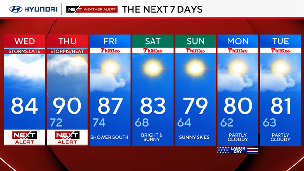
Wednesday: NEXT Weather Alert: Storms. High 84, Low 72
Thursday: NEXT Weather Alert: Storms/heat. High 90, Low 72
Friday: Showers south. High 87, Low 74
Saturday: Bright and sunny. High 83, Low 68
Sunday: Sunny skies. High 79, Low 64
Monday: Partly cloudy. High 80, Low 62
Tuesday: Partly cloudy. High 81, Low 63
Get the latest weather info on the CBS News Philadelphia app.


