Weekend begins in Philadelphia with temps in 70s before Isaias impacts Sunday. Here's the weather forecast.

Despite a weakening tropical system on the way, the weekend in the Philadelphia region will not be a complete washout. In fact, Saturday will be pretty, pretty good.
Filtered sunshine kicks the weekend off Saturday morning as temperatures warm out of the 40s and 50s and make their way back into the mid-to-low 70s in the afternoon.
Cloud cover associated with a weakening Isaias over the southern states will continue to fan north, producing more overcast conditions for the second half of the day. That said, conditions will remain relatively pleasant for the entire day.
NEXT big weather changes
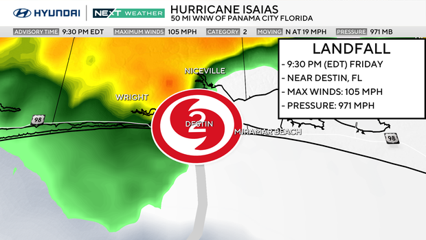
After making landfall Friday night, the storm will weaken significantly as it continues north, but the moisture associated with Isaias will become our NEXT big change.
An approaching upper-level trough will help pull the weakening storm northeastward through the Ohio Valley and toward the Mid-Atlantic. As that happens, the system will begin transitioning away from its tropical structure, but it will still carry tremendous amounts of moisture.
A shower could sneak into the region late Saturday night, but the significant rain holds off until Sunday.
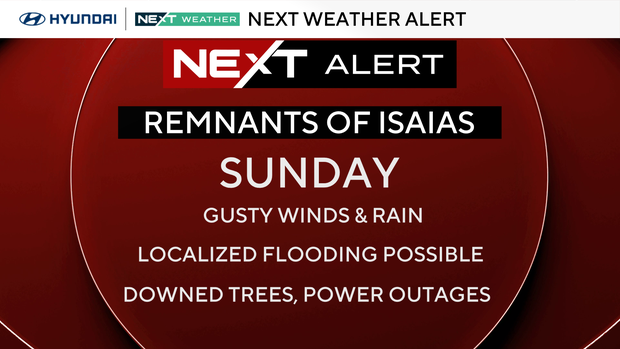
NEXT Weather Alert Day for Sunday
Light rain showers continue to move into the area before sunrise Sunday, becoming widespread and occasionally heavy through the afternoon and evening. This is not looking like a brief passing shower. Several hours of rain are possible, with some embedded downpours and thunderstorms.
Rainfall totals of 1 to 2 inches are expected across much of the region, with locally higher amounts possible. Right now, Delaware and South Jersey have the best chance of exceeding 2 inches, although the placement of the heaviest rain could still shift.
That raises concerns about localized flooding, particularly in poor drainage areas, low-lying roads and locations that have already dealt with significant rainfall recently. Most of the region is under a Level 1 of 4 excessive rainfall risk for Sunday, indicating the potential for isolated flooding.
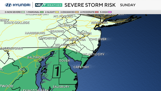
There's also a small severe weather concern, mainly across the southern counties. Wind shear and instability may be sufficient for an isolated severe thunderstorm Sunday afternoon or evening, particularly in Delaware and southern New Jersey. That threat is currently a Level 1 of 5, so it's something to monitor rather than the primary concern.
At the Jersey Shore, increasing easterly and southeasterly winds could create additional problems. Rougher surf and minor tidal flooding are possible Sunday into Monday, particularly around the times of high tide. This does not currently look like a repeat of the prolonged coastal flooding and erosion event we experienced in September, but it's worth watching closely.
For weekend plans, Saturday is absolutely the better choice. If you have pumpkin picking, fall festivals, outdoor sports or anything else scheduled for Sunday, prepare for significant rain interruptions. Sunday afternoon and evening look like the most problematic period, although showers may begin much earlier.
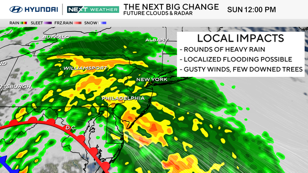
Rain should gradually taper off Monday morning as the remnants pull away, with some improvement during the afternoon. Temperatures recover into the lower 70s.
Tuesday looks much better, with some sunshine and highs climbing back into the mid to upper 70s. Another cold front arrives around midweek, bringing a return to more seasonable October temperatures in the upper 60s.
The bottom line: enjoy Saturday. Sunday looks increasingly wet, and localized flooding is our biggest concern as the remnants of Isaias move through.
Here's your 7-day forecast:
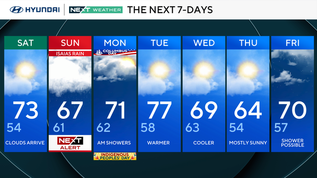
Saturday: Clouds arrive. High 73, Low 54
Sunday: NEXT Weather Alert. High 67, Low 61
Monday: AM showers. High 71, Low 62
Tuesday: Warmer. High 77, Low 58
Wednesday: Cooler. High 69, Low 63
Thursday: Mostly sunny. High 64, Low 54
Friday: Showers possible. High 70, Low 57
Get the latest weather info on the CBS News Philadelphia app.


