Weakening nor'easter storm is departing the Philadelphia region today. Here's the latest weather forecast.
The nor'easter is finally winding down in the Philadelphia region after bringing flooding, beach erosion and power outages across our area.
We still have some bands of rain around on Monday morning with plenty of clouds and high temperatures in the upper 60s. But the rain will gradually taper off, and the winds are much lighter than on Sunday.
Conditions are also improving quickly at the Jersey Shore, however, we're still under a NEXT Weather Alert due to potential for further flooding on Monday morning. Expect minor coastal flooding at most.
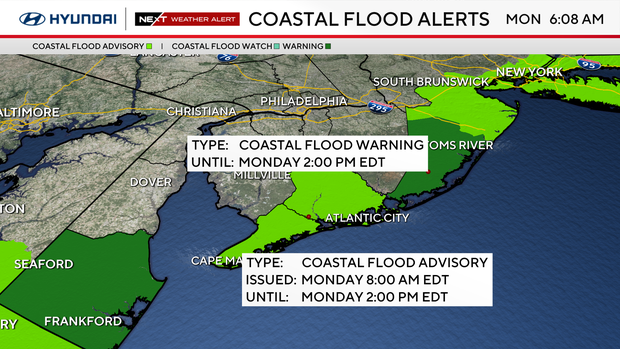
The coastal flood threat has largely ended for Atlantic and Cape May counties, although high water remains a concern in some of the back bays farther north through the morning. These areas remain under flood alerts.
Shore points are watching one last high tide at 9 a.m. that may bring more flooding.
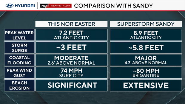
NEXT big change
After Monday, we finally get a stretch of beautiful weather: sunshine returns Tuesday with highs in the low 70s.
Temperatures climb into the upper 70s on Wednesday and around 80 on Thursday.
Here's your 7-day forecast
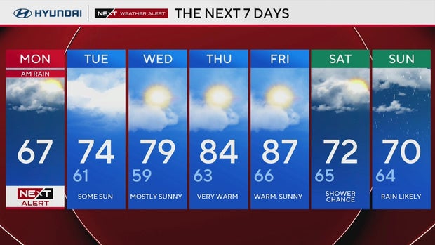
Monday: Damp and cloudy; NEXT Weather Alert as nor'easter moves out. High 67, Low 61
Tuesday: Some sun. High 74, Low 61
Wednesday: Mostly sunny. High 79, Low 59
Thursday: Summer-like start to October. High 84, Low 63
Friday: Warm and sunny. High 87, Low 66
Saturday: Turning cooler, shower chances. High 72, Low 65
Sunday: Rain likely. High 70, Low 64
Get the latest weather info on the CBS News Philadelphia app.


