Hurricane trackers monitoring tropical disturbance in Gulf: Here's how it could affect Georgia

For the rest of the week, CBS News Atlanta will track the continued development of a tropical disturbance over the southwestern Gulf that could have an impact on the weekend for the Southeastern United States and North Georgia.
Although it is too early to know the specific track, intensity, and impacts as of Tuesday, the National Hurricane Center has labeled this area with a 90% chance of tropical formation in the next seven days. Therefore, it is likely that this system will become either a tropical depression or Tropical Storm Isaias within the next day or two.
After initially drifting east over the southern Gulf, the atmospheric steering between a high-pressure system along the Eastern Seaboard and low pressure across the western U.S. will pick the system up and likely bring whatever becomes of it northward into the northern Gulf and somewhere along the Gulf Coast region during the end of the week.
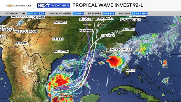
The exact scale and breadth of impacts to North Georgia are still a couple of days off. As is typical, computer models are struggling to handle this potential tropical system because its defined circulation has not quite yet developed.
The National Oceanic and Atmospheric Administration (NOAA) will be sending a plane into the environment around the system to gather data today, and hurricane hunters will be taking readings from around and inside the developing system Wednesday, which will lead to increased forecast certainty and accuracy.
Although things can and likely will adjust, given the current scenario, putting Georgia on the east side of the circulation, our forecast over the weekend into early next week includes the return of increased showers and thunderstorms, potential severe weather, and gusty breezes.
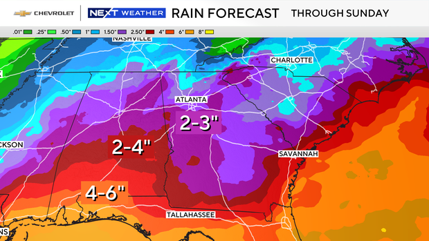
Winds will be dependent on the proximity of any potential tropical system as well as its eventual strength as it moves inland. Winds of at least 15 mph and gusts up to 25 to 30 mph are certainly a possibility. In terms of rainfall, over 1 inch of rain is possible, with periods of heavy rain that may cause flash flooding and rises in rivers, creeks, and streams.
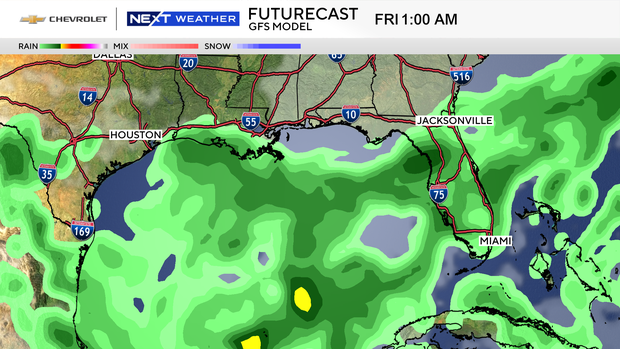
Again, there is still plenty of uncertainty in the forecast, and we'll be tracking this closely as the details hammer out in the next couple of days.


