Remnants of Hurricane Isaias will bring heavy rain, gusty winds to Philadelphia region. Here's what to know.

Hurricane Isaias made landfall along the Florida Panhandle near Destin Friday evening as a Category 2 hurricane. The system has since lost its tropical characteristics, but its remnant area of low pressure will track directly toward the Philadelphia region through Sunday.
Rain associated with the system will begin to move in from the southwest overnight Saturday and into the pre-dawn hours Sunday. The rain will start out light and scattered before becoming more widespread through the second half of Sunday morning and into the afternoon. Periods of steady rain are expected through midday, with pockets of heavier rainfall developing at times.

While widespread flooding is not expected, localized flooding may develop in poor-drainage and urban areas, especially where multiple rounds of heavier rain occur. Rainfall totals from Sunday through early Monday morning will generally range from 1 to 2 inches, although some locations could pick up closer to 3 inches.
Winds will also increase through the day Sunday. Sustained winds of 10 to 20 mph are expected by afternoon, with gusts across much of the Delaware Valley reaching 20 to 30 mph. Along the coast, wind gusts could approach 40 mph.
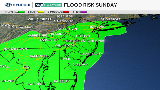
The combination of gusty winds and periods of steady rain could bring down tree limbs and, in a few cases, even entire trees. As a result, scattered power outages will be possible through Sunday afternoon.
An easterly wind Saturday night into Sunday will also push additional water into the Delaware Bay around the time of high tide Sunday afternoon. A coastal flood advisory remains in effect for Kent County, Delaware, until 1 p.m. Sunday due to the threat of minor coastal flooding.
Temperatures Sunday will remain nearly steady throughout the day. Most locations will start in the lower 60s during the morning and only warm into the middle 60s by afternoon under the clouds and rain.
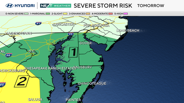
By Sunday evening, both the steady rain and gusty winds will begin to diminish. Scattered showers and a few thunderstorms may linger through early Monday morning as the main low pressure system moves through the region.
Rain will gradually taper off Monday afternoon, with sunshine slowly returning later in the day and setting the stage for a stretch of drier weather for much of next week.


