Winter weather advisory issued as snow arrives in Philadelphia area this weekend. Here's the weather forecast.
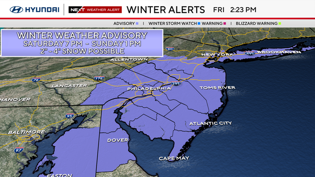
A winter weather advisory has been issued for the Philadelphia region, except for the Lehigh Valley and Poconos, for Saturday night into early Sunday morning. The advisory is in effect from 7 p.m. Saturday until 1 a.m. Sunday.
Philadelphia, South Jersey and parts of Delaware are anticipating seeing the first measurable snowfall since February.
Is it going to snow on Sunday? Our NEXT big weather change
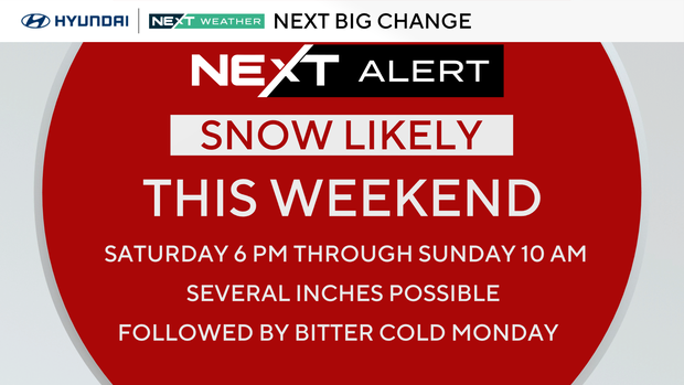
We are tracking weekend snow that's likely to start falling Saturday night and continue into Sunday morning. We've issued a NEXT Weather Alert for this first snowfall since February and possible travel impacts over the weekend.
The region could see between 2 and 4 inches of snow. The highest totals are expected from the I-95 corridor, Philadelphia and east.
This may start as a light rain or rain mix before quickly turning to snow. Current forecasts predict that snow should begin in Philadelphia between 8 and 10 p.m.
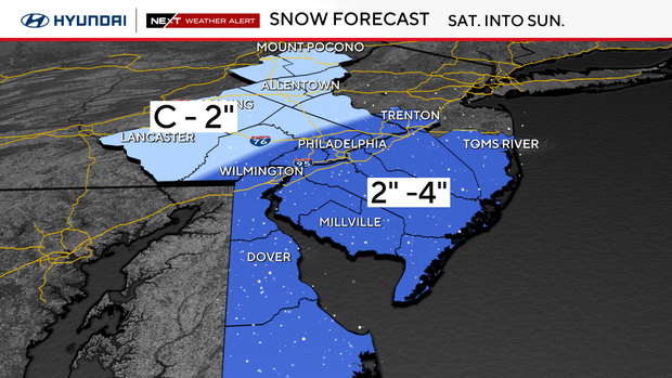
The storm will exit the shore Sunday between 8 and 10 a.m., but blowing snow and snow-packed roads will persist as the skies clear and frigid air arrives.
Northwest winds will gust to 30 mph and snow squalls are possible later in the day Sunday for the Poconos, Lehigh Valley and upper Bucks, Chester and Montgomery counties.
Bonus big change
Our coldest push of Arctic air arrives on northwest winds behind the storm Sunday.
Temperatures will fall into the 20s, and winds will create a feel-like temps in the teens and single digits through Monday.
Looking ahead
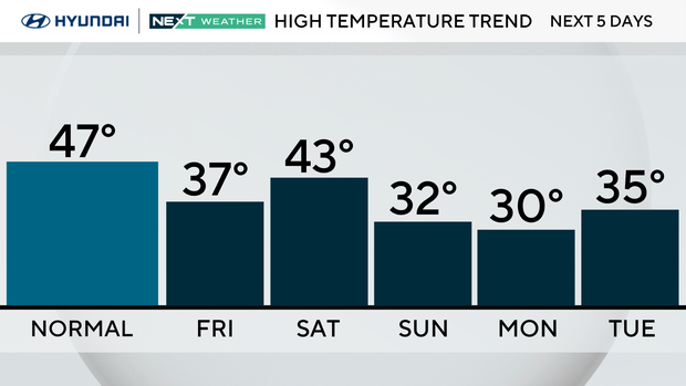
We slowly warm after Monday with the first temperature above average and the first 50s since before Thanksgiving arriving by Friday. Reminder: We are still in fall — it's not winter yet. The winter solstice begins Dec. 21, a week from Sunday.
Here's your 7-day forecast:
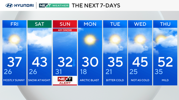
Friday: Mostly sunny. High 37, Low 26.
Saturday: Snow at night. High 43, Low 26.
Sunday: NEXT Weather Alert for morning snow. High 32, Low 31.
Monday: Arctic blast. High 30. Low 18.
Tuesday: Bitter cold. High 35, Low 21.
Wednesday: Not as cold. High 45, Low 25.
Thursday: Mild. High 52, Low 35.